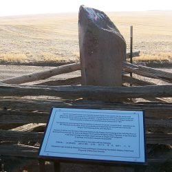
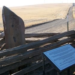
In Ogle’s Standard Atlas of Sherman County, 1913, Lenard’s Rock is in the middle of section 8, T1N, R19E, and S of the road to McDonald on the John Day River. Dan Leonard is shown in the 1860 U.S. Census, Fall River Precinct in Wasco County, and lived at the Oregon Trail Crossing of the John Day River. Originally located well off the county road, it was moved to the county roadside where it was broken into two parts, reportedly by a road grader.
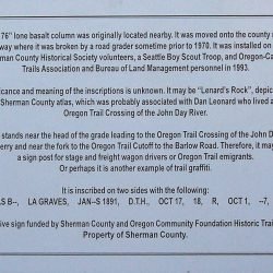
Sherman County Historical Society trustees enlisted the help of Oregon Historical Society and Oregon-California Trails Association scholars for study in 1992 and restoration and installation in the County road right-of-way in 1993 where it is the property of Sherman County. The Sherman County Court erected an interpretive marker in 2008.
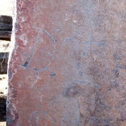
Legible inscriptions found on the basalt column in 1970 included: CHAS BO; LA GRAVES; OCT 1; JAN—S; 1891; D.T.H.; OCT 17; 18; and two initials, R. The Sherman County Court erected an interpretive marker in 2008. Is Leonard’s Rock one and the same as the inscribed basalt column? Did it mark the fork in the Oregon Trail or graves? ~ Lloyd Gosson; Gordon Hilderbrand; Oregon-California Trails Association; Sherman County Historical Society; and Oregon Historical Society.
Is Leonard’s Rock one and the same as the inscribed basalt column? Did it mark the fork in the Oregon Trail or graves?

