
Public art in Sherman County, Oregon, has a long history dating back to the 1890s. This collection includes work in the the following categories – Murals, Mosaics and Mascots; Itinerant Sign Painters and Artists; Heritage and Monuments; Business; and Government.
If you would like to contribute information, photos and/or corrections please send us a note. We would appreciate your engagement.
Murals, Mosaics and Mascots
By Sherry Kaseberg
Photographs by the author or as credited
Grass Valley, Oregon
South Sherman Elementary School – Grass Valley, Oregon
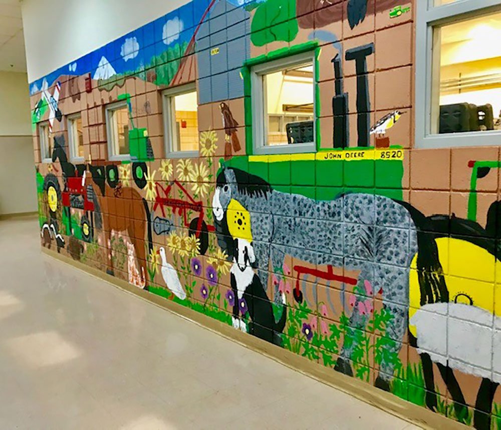
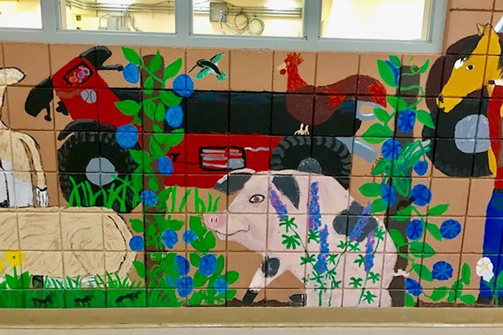
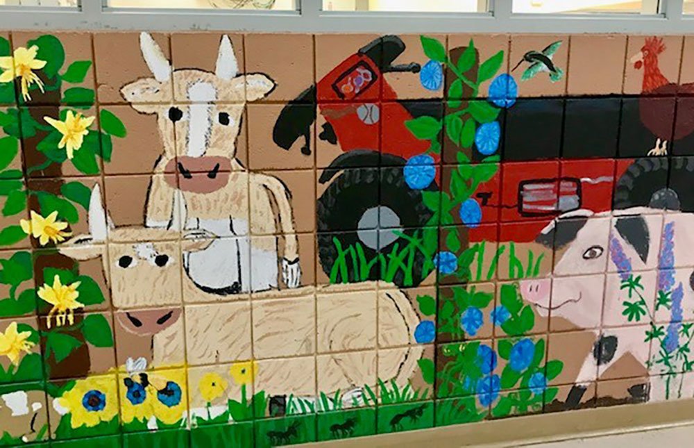

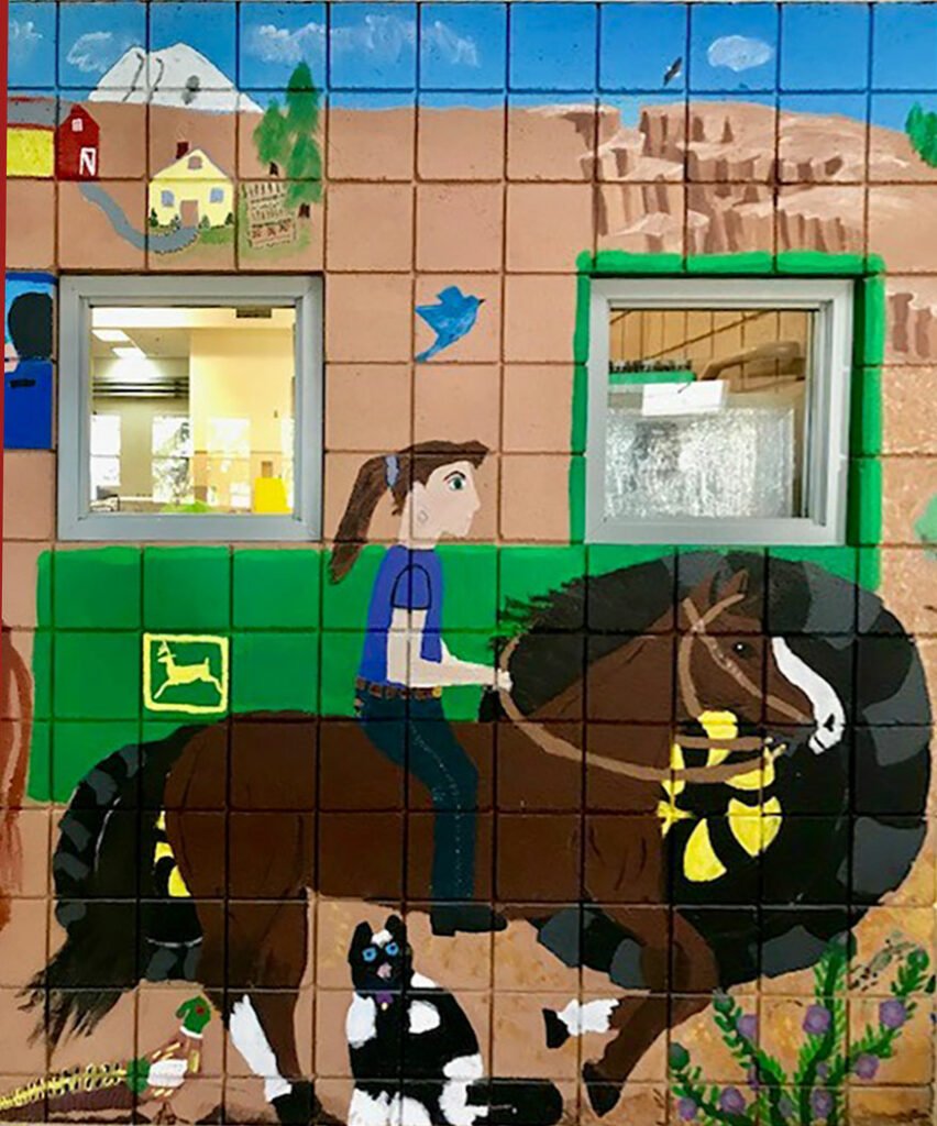
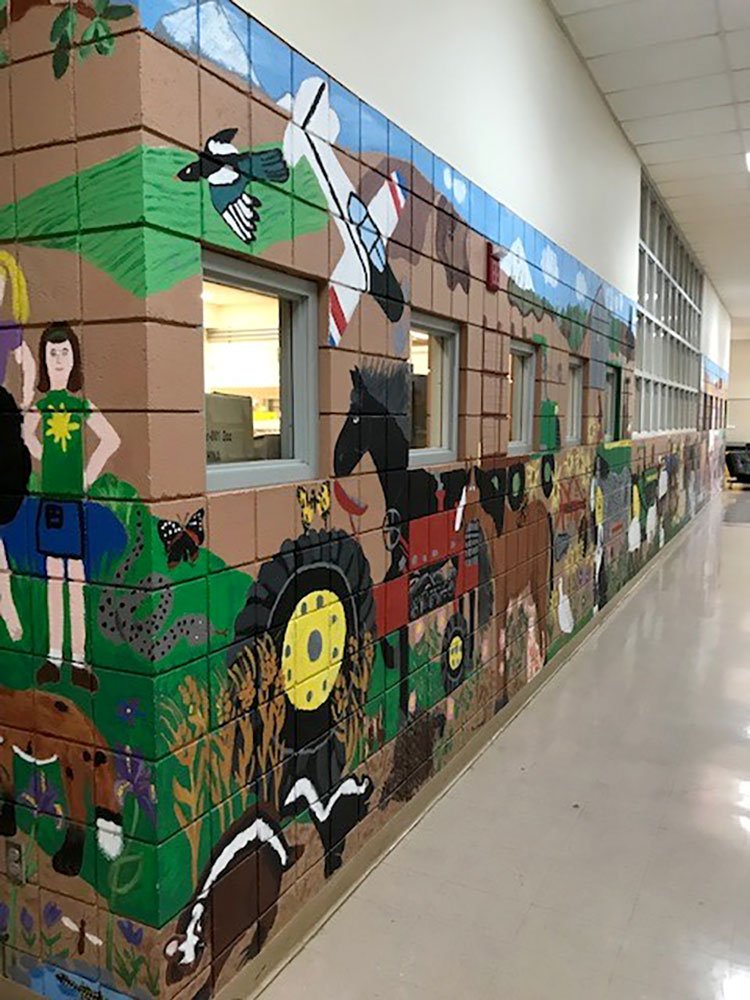
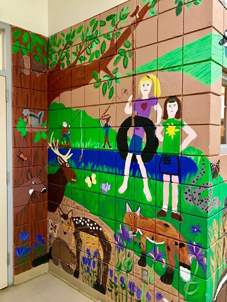
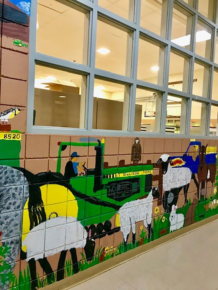
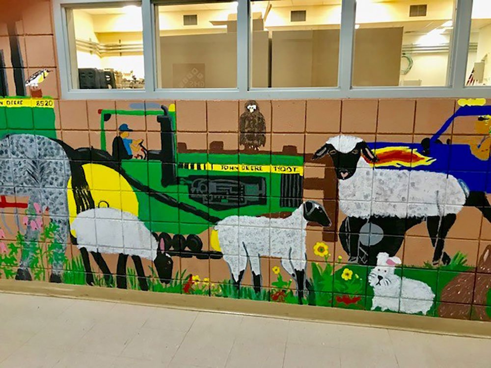
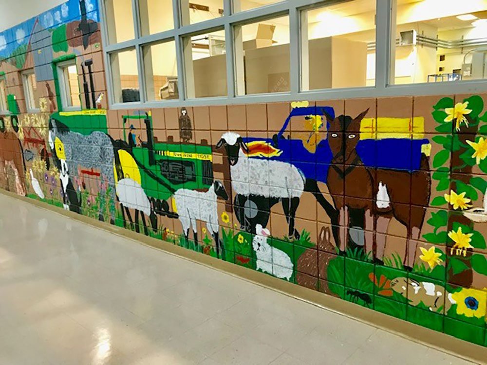

Murals, mosaics and mascots in our schools were collaborative efforts that stimulated discovery and learning about art. While the building is no longer used as a school and houses a private business, the murals remain.
If you have additional information on the South Sherman Elementary School mural project, please contact us us. Photos courtesy of Jean Luxford Hulbert.
Moro, Oregon
Moro Commercial Brick Building – Moro, Oregon
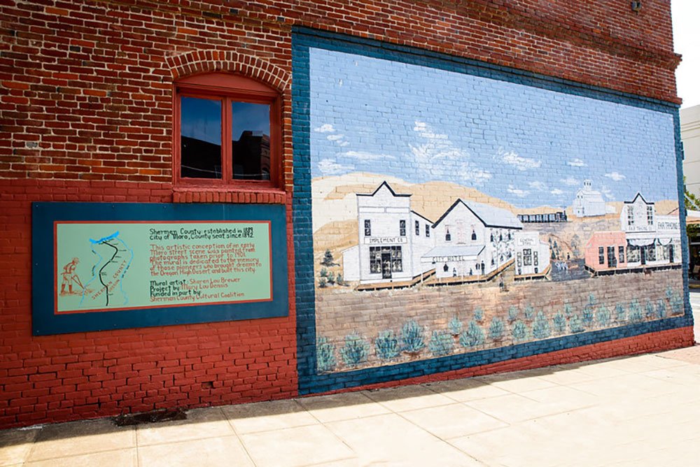

Two murals adorn a historic brick building at the corner of First St. and Main St. (Hwy 97) in downtown Moro, Oregon. Mary Lou Dennis commissioned the two murals while she owned the building. The text on the placards (below) describes the scene and credits the artist, project and additional funding source.
Sherman County: established in 1889. City of Moro, County Seat since 1892. This artistic conception of an early Moro street scene was painted from photographs taken prior to 1901. The mural is dedicated to the memory of those pioneers who brought dreams to the Oregon High Desert and built this city. Mural artist: S.L. Brewer. Project by Mary Lou Dennis. Funded in part by Sherman County Cultural Coalition.
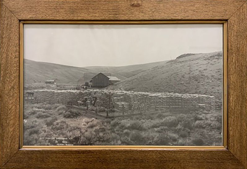
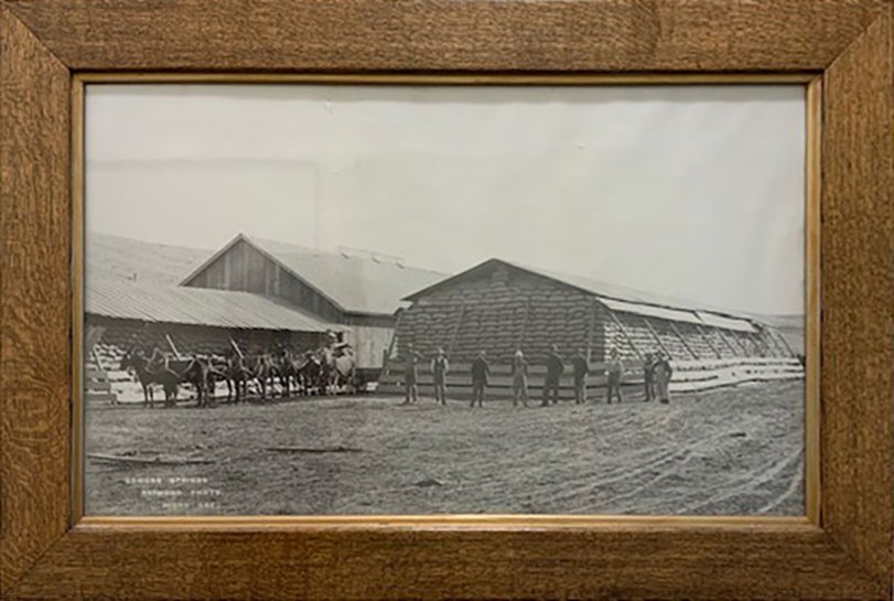
Columbia Southern Railway Biggs to Shaniko. First train May 13, 1900. Tracks flooded out in 1964. Shaniko 1900 largest wool shipping in the world. Photos courtesy of Jeremy Lanthorn.
mural: a painting applied to and made integral with the surface of a wall or ceiling.
Britannicas
Moro School

“The Gridiron Stomp. The Husky mascot was drawn by Sherry Woods and was put on an orange paper background behind the band which played on the stage. .. Paper football jerseys decorated the walls.” The Husky 1955 Moro, Oregon.
Inspired by the original mascot designed by _______, Sherry Woods recreated the Husky mascot for the Gridiron Stomp dance.
Mascot – mascot: a person, animal, or object adopted by a group as a symbolic figure, especially to bring good luck, or one that represents an organization.
Merriam-Webster Dictionary
Sherman County School
Lost in the mist of time, a mural inside of the high school lobby was created around 2001. Do you have photos and/or information on this project? Please contact us.
Country Landscape, 1979 (Sherman Union High School)


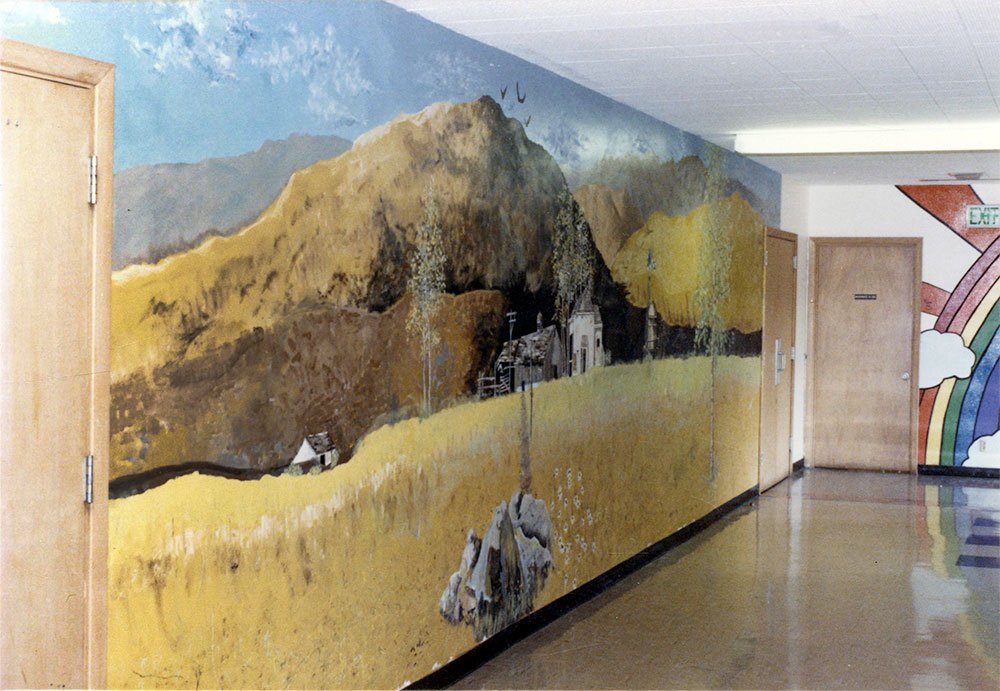
Country landscape by Nancy von Borstel (graduated 1979) and Cameron Kaseberg (graduated 1981) on the wall outside the cafeteria at Sherman Union High School, 1979. Photos courtesy of Cameron Kaseberg.
Race Car Mural, 1980 (Sherman Union High School)
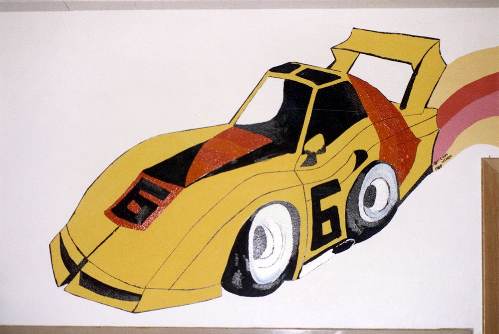
A race car mural was painted during Shirley Fritts’ art class by Cameron Kaseberg and Wendy McDermid to brighten up the hallways at Sherman Union High School, 1980. Photo courtesy of Cameron Kaseberg
Rainbow Brightens Sherman Union High School

The Sherman Union High School Art Department continued to brighten the halls under the direction of Shirley Fritts. The rainbow mural, painted by Kim Kaseberg and Cameron Kaseberg in 1980, could be seen all the way down the main hall. Photo courtesy of Cameron Kaseberg
Mural from Grass Valley School Moved to Sherman County School.
This South Sherman Elementary School mural is now at Sherman County School. The mural was moved from South Sherman Elementary School in Grass Valley when the Sherman County School elementary wing opened. If you have additional information (artists, dates), please contact us. Photo courtesy of Jeremy Lanthorn.
Sherman County Historical Museum
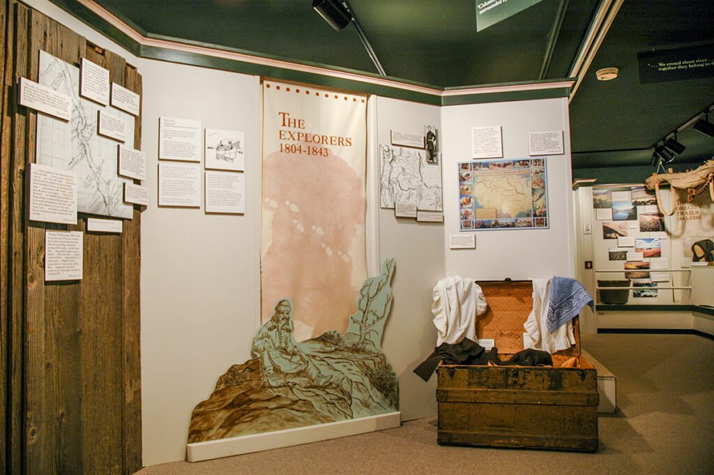
The Murals of The Oregon Trails, Rails and Roads Exhibit
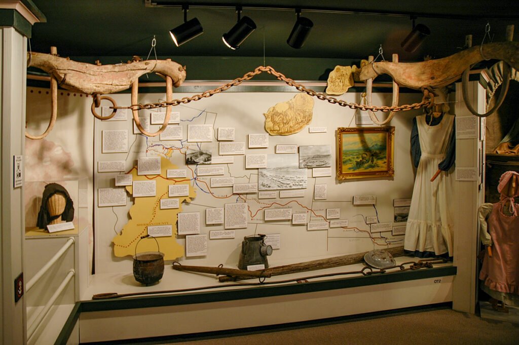

A resourceful, creative and hardworking exhibit team worked uncounted hours for 15 months: Myrna Melzer, Joe and Sheila Weber, Sherry Kaseberg, Millie Moore Voll, Doris Alley, Penny Eakin, Mavis Olsen, Eileen Moreau, Dorothy Thompson, Jerry Kirkpatrick, Chet Coats, Janet Van Gilder. The team worked entirely by consensus…concepts, text, artifacts, illustrations and graphics.
The team invited artists and craftsmen with county connections who were willing to work for half-pay and an opportunity to learn new skills. Cameron Kaseberg was charged with exhibit design, layout and panel design. Jeanney McArthur, graphic designer, was charged with the design of the exhibit brochure, color scheme and label production. Pat Jacobsen, sign painter, was assigned to the Oregon Trail map panel and all vinyl lettering. All three worked beyond their normal range of expertise.
The mural at the exhibit entry was designed by Myrna Melzer who with Doris Alley, Penny Eakin, Carole Thompson, Betty Rathbun, Dick Voll, Ann Bothwell, Jean Woodrum, Barbara Cantrall, Deanna Padget, and Shirley Fritts, painted it at the fairgrounds and carefully moved it to the museum for installation.
Around the corner and beneath more ox yokes, diary quotes tell the story on a map of the Oregon Trail, produced by Joe Weber and Pat Jacobsen.
Others joined the team with paint brushes, sewing machines, computers and woodworking tools: Nancy Fields, Gail Macnab, Leroy Martin, Penny Eakin, Reatha Coats, Anne Franklin, Delbert Wooderson, Ron Thompson, Malcolm McDermid, Everett Hawthorne and Ross R. Cotroneo, Ph.D., Western Oregon University, served as exhibit scholar.
Maps, information and photographs were obtained from Oregon History Center, Wasco County/The Dalles Library, McMinnville Public Library, Library of Congress, Stark Foundation in Texas, and Union Pacific Railroad Museum in Omaha, and personal collections.
Photos courtesy of Cameron Kaseberg.
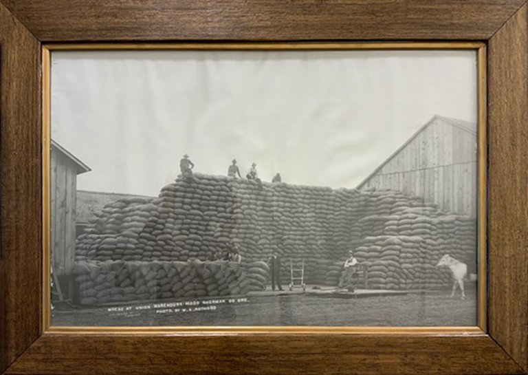
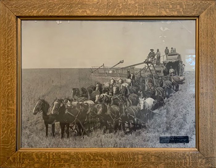
The Murals of the Wheat Through the Ages Exhibit
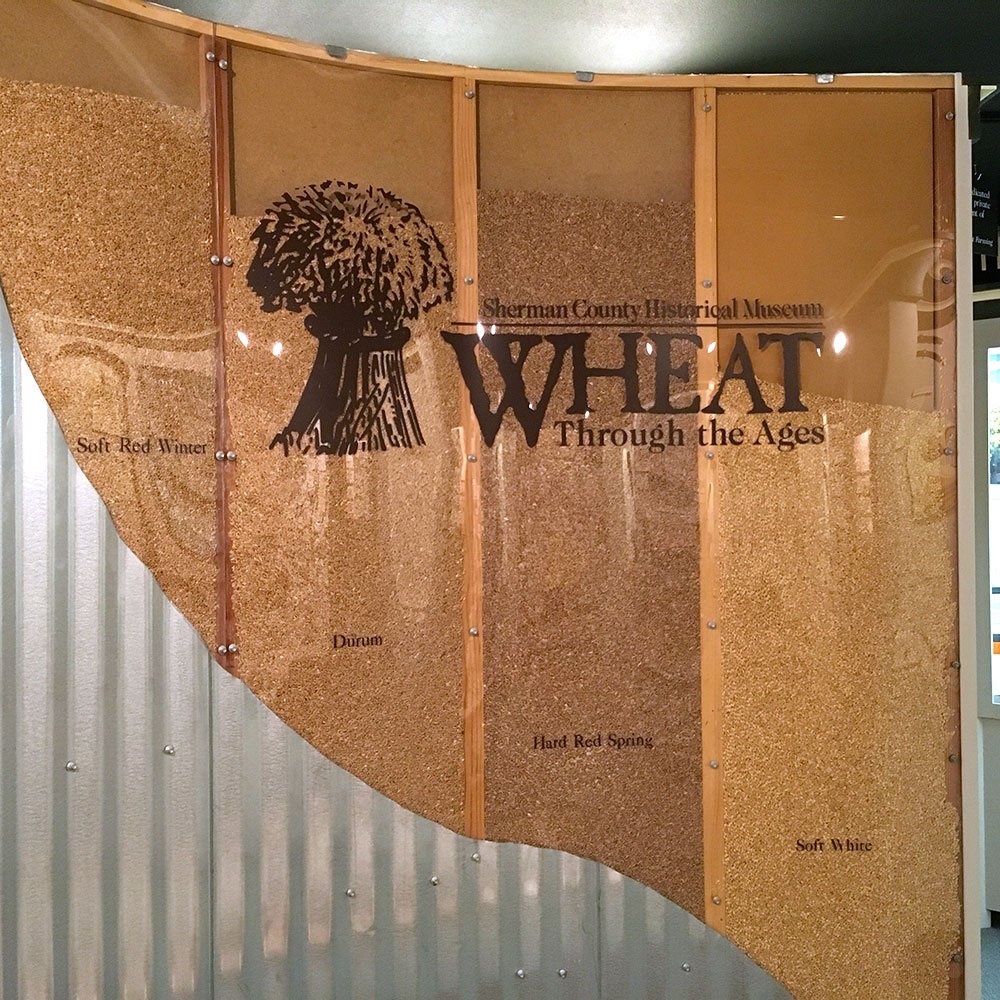


The all-volunteer museum exhibit team of Charlotte Barnett, Chet Coats, Sherry Kaseberg, Myrna Melzer and Joe Weber worked with exhibit designer Cameron Kaseberg, carpenter David Fritts, and scholars, Kim Stafford, Ph.D., Lewis and Clark College, and Warren Kronstad, Ph.D., Oregon State College. The Wheat Through The Ages exhibit is a blend of disciplines, science and the humanities, and illustrates wheat varieties, research, farming, production, marketing, shipping and products.
The exhibit entrance was designed to reference grain bins as a cutaway displaying various wheat varieties. Designed by Cameron Kaseberg and constructed by David Fritts.
The exhibit also features a ‘waterfall’ of foods made from soft white winter wheat cascading over the exhibit wall demonstrating the wide variety of foods made by wheat grown in the region. Created by Cameron Kaseberg and Rosalind Laknas.
Near the entrance to the exhibit, a large mural created by Penny Eakin depicts wheat growing regions of the world and helps tell the story of Sherman County’s importance in the history of wheat production.
Funded by Burlington Northern-Santa Fe, Morrow County Grain Growers, Barbara Kaseberg Riper, Oregon Council for the Humanities, Sprint and Society members, it is designed for the 98% of us who are generations removed from farming.
Photos courtesy of the Sherman County Historical Society and Cameron Kaseberg
The Conservation, Cultivation and Clothespins Exhibit
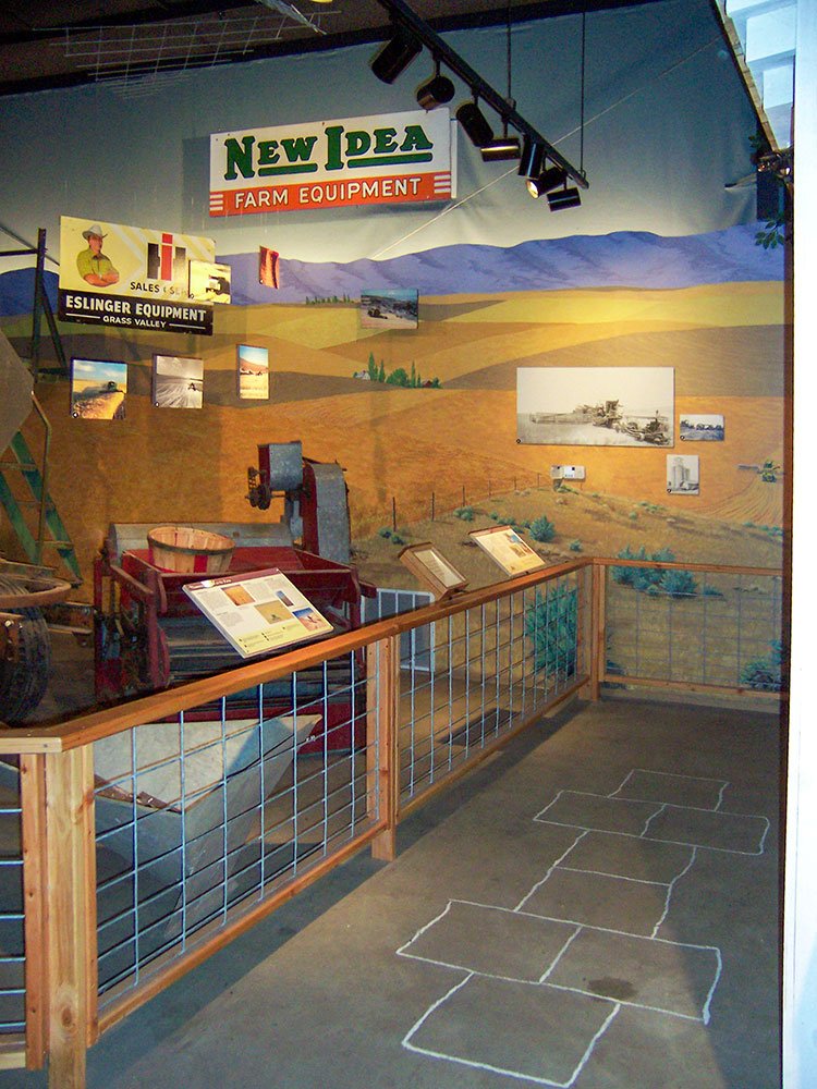
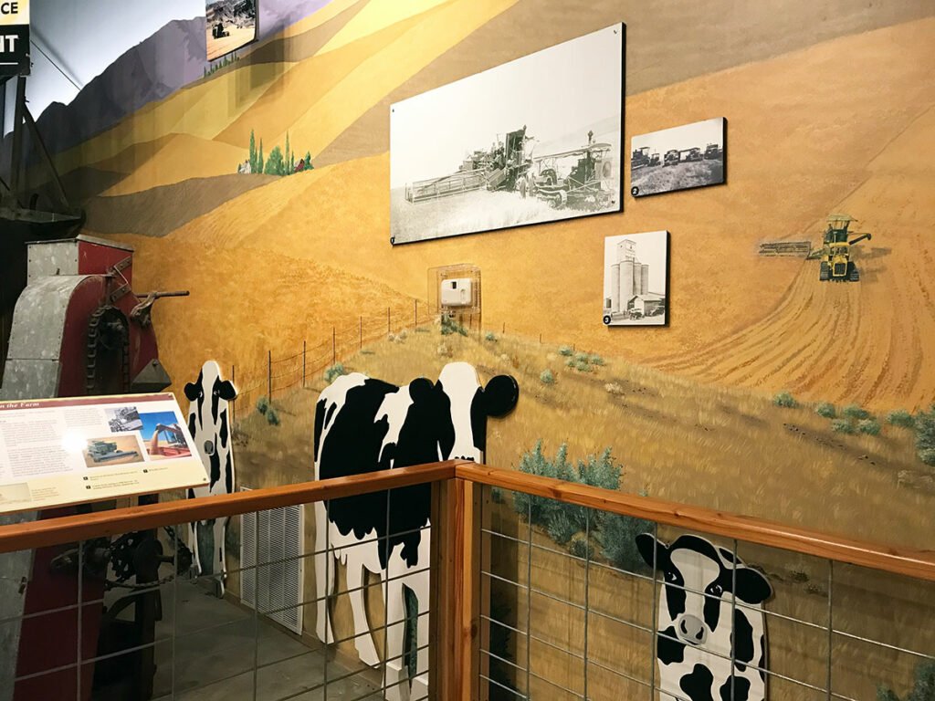
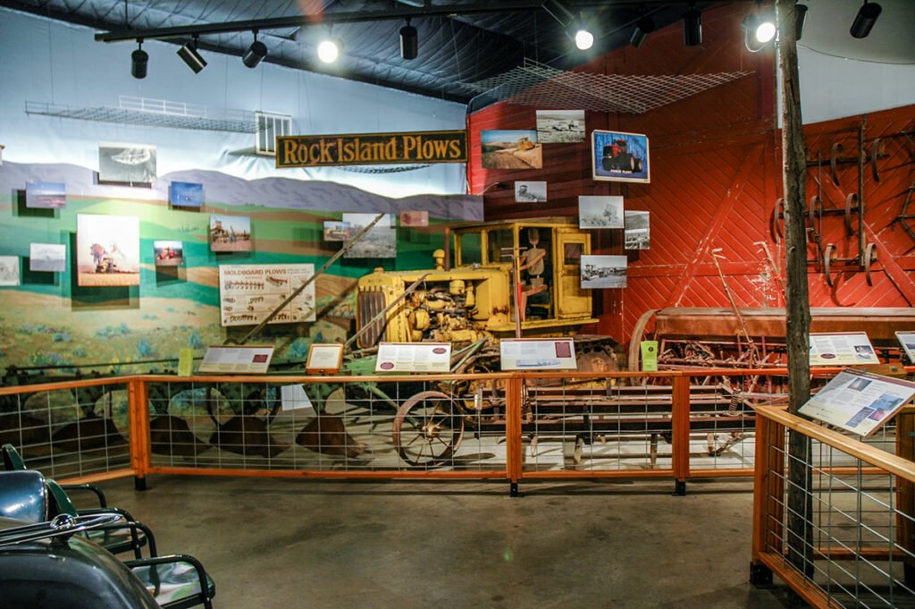
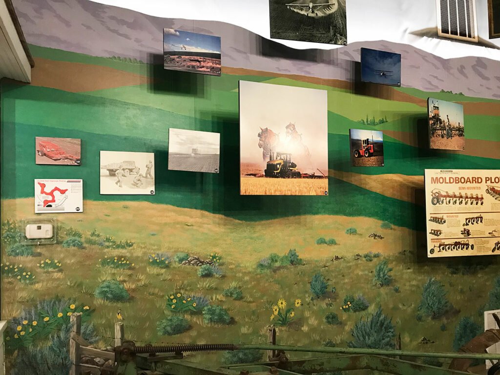
The Conservation, Cultivation and Clothespins Exhibit takes the visitor on a journey through the county’s history of conservation, farming and rural life using electricity, engines and motors, large farm implements, conservation measures, a rural kitchen, clothesline and clothespins, and a farm shop combined with barn doors and elements of grain warehouses, steel and wood grain bins to illustrate rural changes.
The exhibit team produced a mural to complement the exhibit, Conservation, Cultivation and Clothespins, that opened in 2002. Mary Anne Macnab, Sheila Weber, Susan Brown, Nancy Fields, Myrna Melzer, Pat Jacobsen, Joe Weber, Katie Wooderson, Pat von Borstel, Shirley Fritts and Dick Voll worked together, mixed the colors for spring grain, rocky outcroppings, distant hills, summer fallow, ripe grain, stubble and a road and brought it all together with their amazing talent.
The exhibit was designed by Cameron Kaseberg, constructed by David Fritts, and produced by Sherman County Road Department, Chris and Carrie Kaseberg, Gary Brown, Mary Beth Smith, Sandy Macnab, Erling Jacobsen, Jim Manning, Mary Ann King, Rick Danielson and FFA members, David Macnab, Keegan Kock and Colby Weedman.
The building and this exhibit were funded by over 200 individual donors, and the Meyer Memorial Trust, The Collins Foundation, Oregon Economic Development Department, Burlington Northern-Santa Fe Foundation, Columbia Plateau Conservation Resource Center and many generous donors of goods and services.
Photos courtesy of the Sherman County Historical Society and Cameron Kaseberg
Summer Youth Public Arts Project
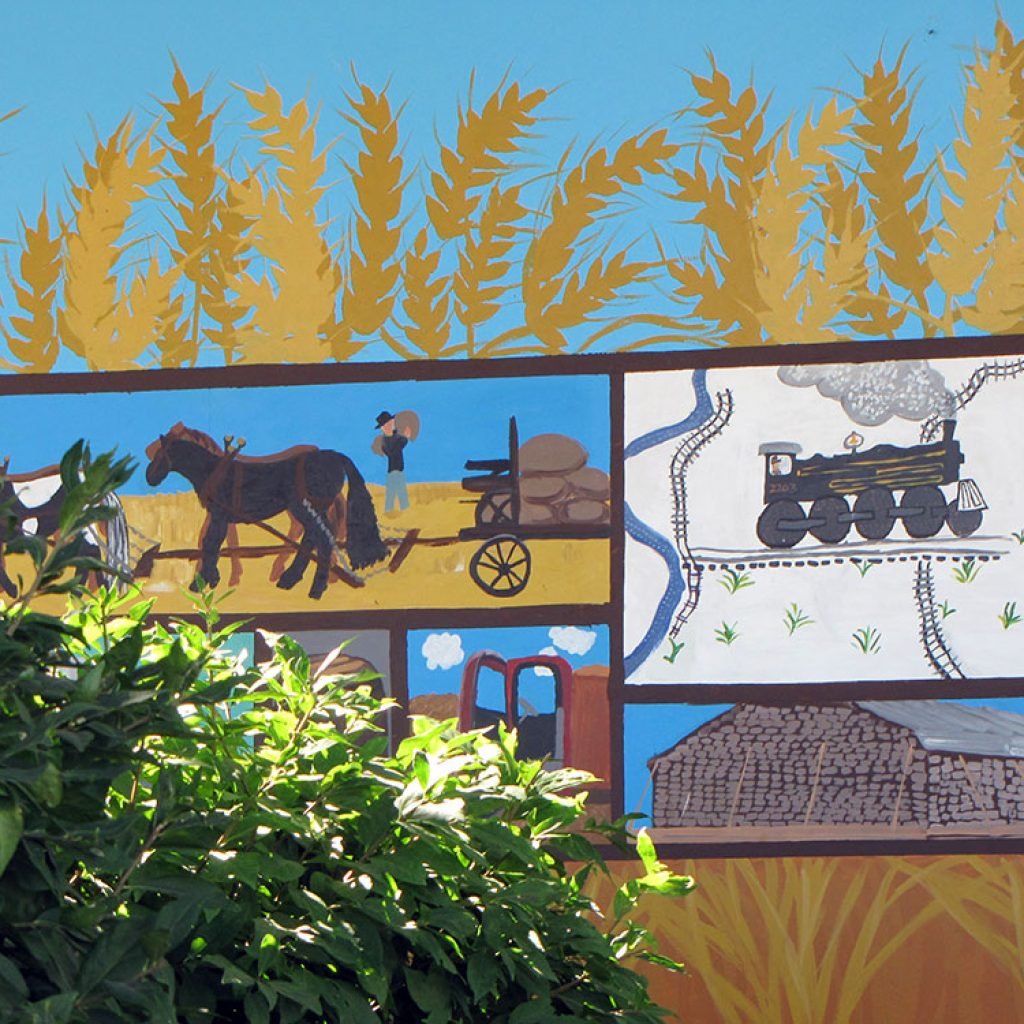
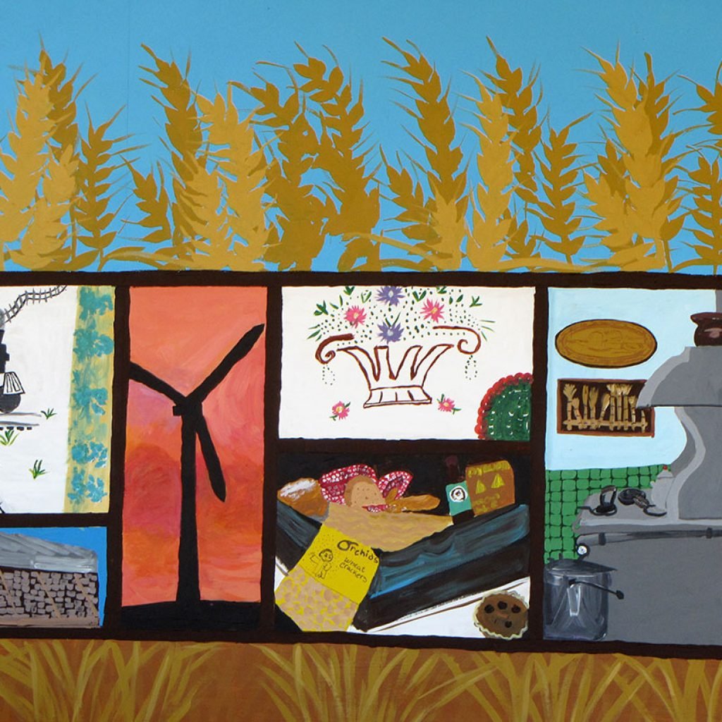
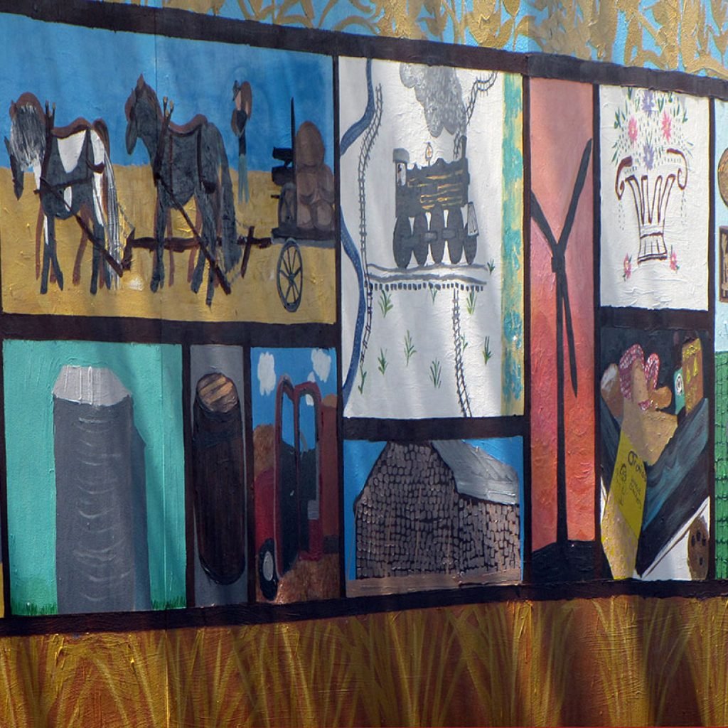


In 2010, Sherman County Cultural Coalition, Sherman County Commission on Children and Families, Chris and Carrie Kaseberg, and Sherman County Historical Society collaborated to fund a summer youth public arts project. This experience involved planning, assigning tasks, drawing museum artifacts, mixing colors, painting and working together. Left to right, Jeanna Hill, Karolyn Kaseberg, Courtney Kivett, Paige McLeod, Tyler Lyon, Rebekah Bourgeois and artist-in-residence Janet Essley created a mural that offers clues to what is found in museum exhibits. Photos courtesy of Jeremy Lanthorn.
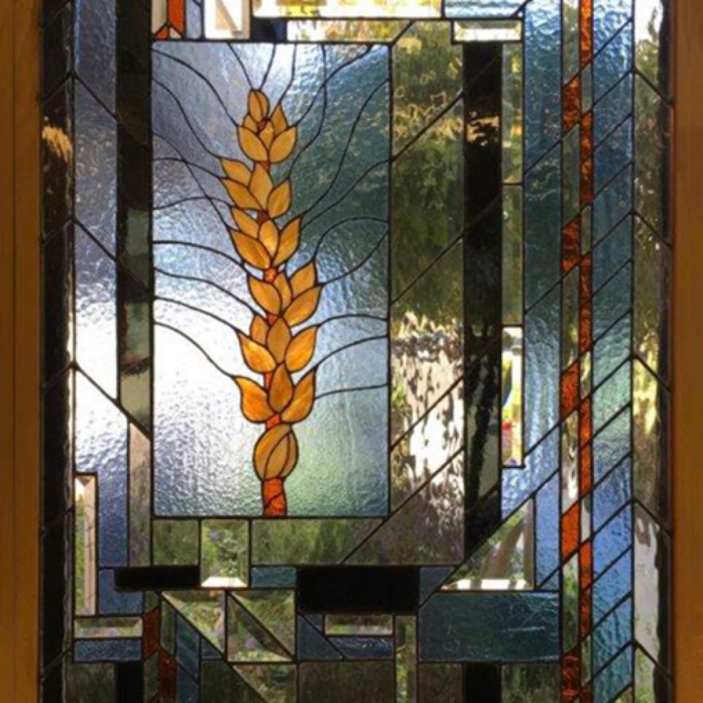
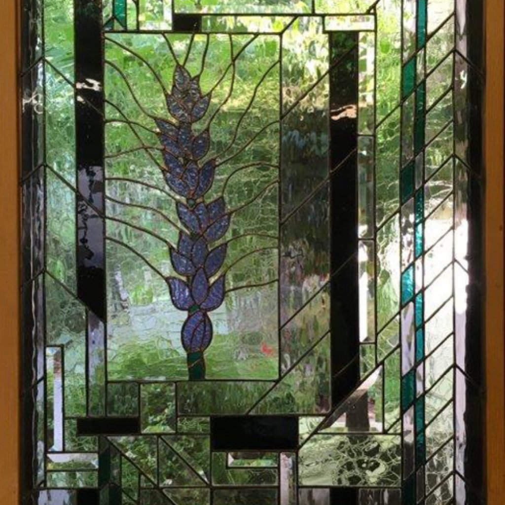
Museum Stained Glass

Local artist, Betty Jean (Medler) Rathbun, created this stained glass work (horse, rider and mountain) in memory of her husband, Floyd (1920-1993), a wheat and cattle rancher who volunteered for Boy Scouts, 4-H and the Sherman County Historical Museum.
Dean M. Wilcox, M.D. and his artist wife, Beryl, created these stained glass pieces (geometric shapes and wheat heads) that reflect the William B. and Jennie Wilcox and George and Marie (Morrison) Wilcox wheat farm where Dr. Wilcox grew up.
Steve Burnet Extension & Research Building

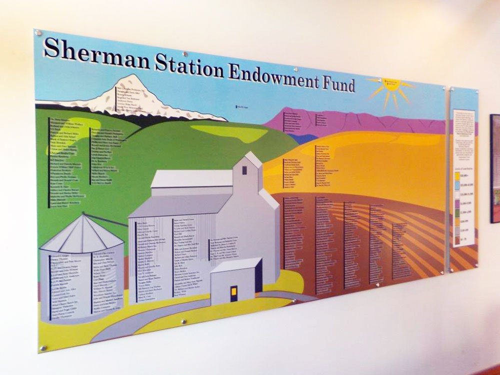
The first endowment donor board painted by Pat Jacobsen was prominently displayed on the original Experiment Station exterior. The new endowment board is displayed at the Steve Burnet Extension & Research Building entrance at the Sherman County, OSU Research Station. Photos courtesy of Sue Mabe.
Rufus, Oregon
Ceramic Mosaic
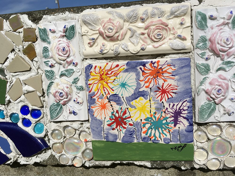

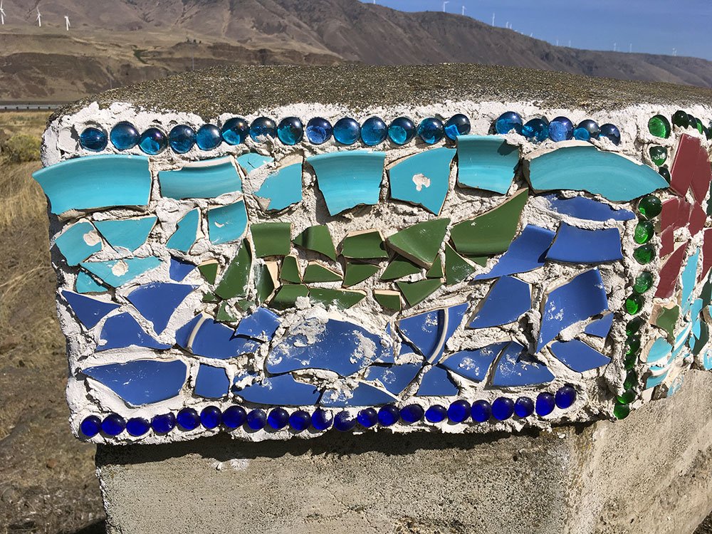
The broken pottery mosaic in downtown Rufus represents a unique effort by Pat Jacobsen, Janice Strand, Sabrina Absolon and others. Photos courtesy of Erling Jacobsen.
North Sherman Elementary School
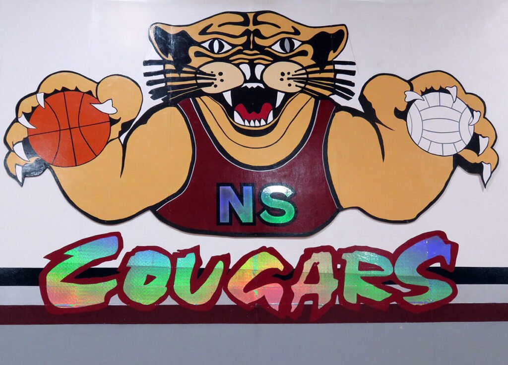
North Sherman Elementary School’s mascot is the work of artist Pat Jacobsen and students Carmen Diaz, Mel Diaz, KC Lissman, Annette Melcher, Paige Melzer, Jenna Mersy, Jessica Nagel and Stacie Weathers. The Cougar followed students when they joined classes at Wasco. Photo courtesy of Erling Jacobsen
Wasco, Oregon
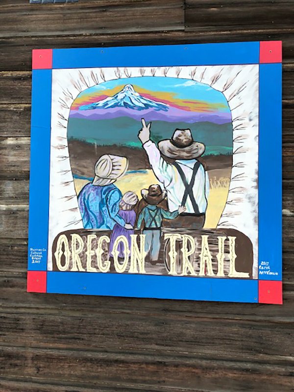
Wasco Elementary School
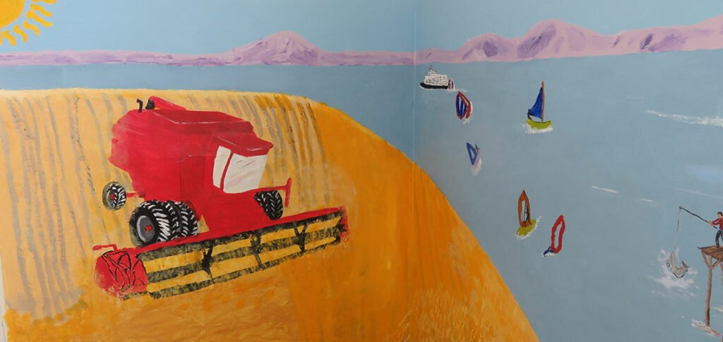

Student muralists expressed their views of the world around them, the Columbia River, wind farms, wheat farming, the town and their school. Photos courtesy of Linda Krafsic.
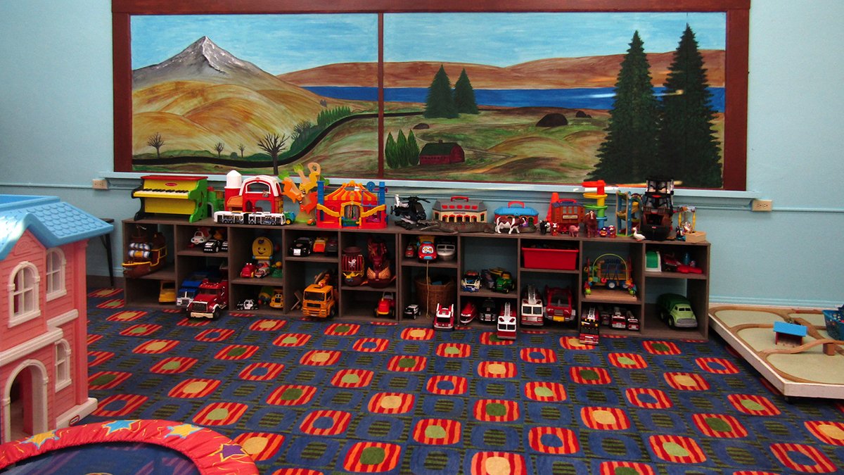
This mural was painted on an old bulletin board in the historic Wasco school in 2021. We wanted the Sherman Kids Zone play space to be filled with bright colors and artwork, and we incorporated elements of local history and geography. We chose a landscape view of the mountain, the river, winding roads and fields of wheat. The artist is mostly a hobby painter, and she had a lot of fun doing this mural at the Sherman Kids Zone. Photo and mural by Jessica Richelderfer Wheeler
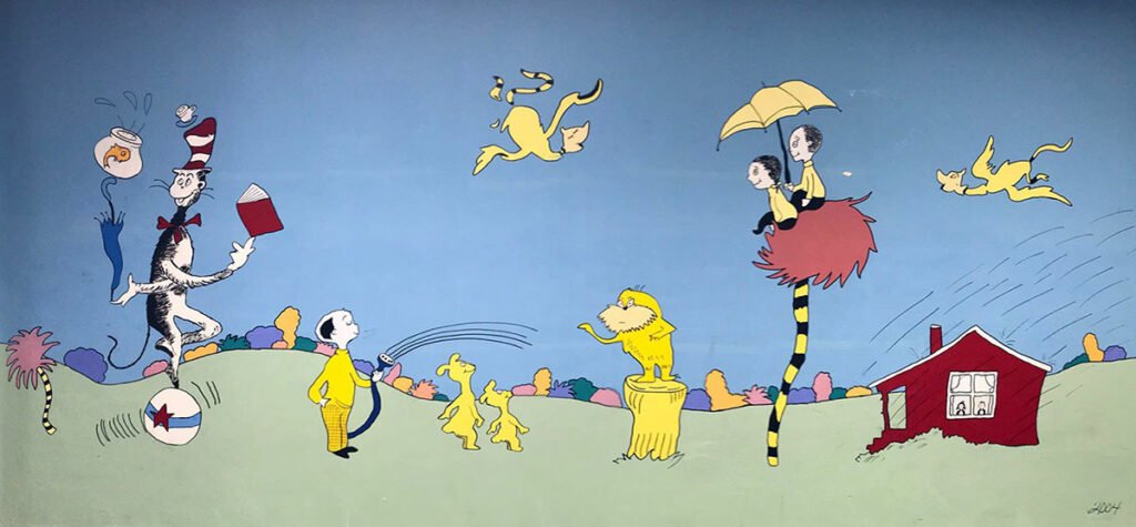
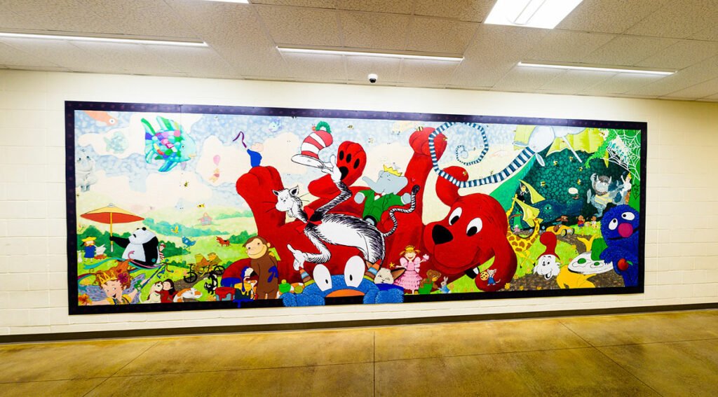
Characters from Dr. Seuss books were painted by Jeanne Dabulskis. Photo courtesy of Jessica Kaseberg Ball.

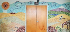
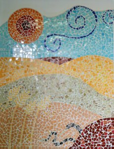
This colorful mosaic greets visitors to the Wasco School Events Center’s Lee Schwendel Auditorium. Photos courtesy of Linda Krafsic.
Itinerant Sign Painters and Artists
“The itinerant sign-painter was one of the little-sung artists of America who left a lasting impression on the lore of the countryside… With his office in his hat and no more equipment than he could hold in a small box, people got to know his work and waited for the next time he came through town for their signs. ~ Eric Sloane, Our Vanishing Landscape.
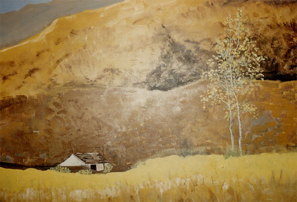
Joseph John Englehart
A painting in a tavern. A prolific painter, Joseph John Englehart was known throughout the Northwest for his oil paintings of Oregon, Washington and California scenes. Born in Chicago in 1867, he had studios in San Francisco and Tacoma where he painted area landscapes. From 1902 to 1904 he had a studio in Portland. His work, of important historical and aesthetic interest, is represented in major art museums and in a collection at the Baldwin Saloon in The Dalles. It is said that he bartered his work for food, drink and lodging.

That may explain how a tavern in Grass Valley had long displayed this 8’ x 4’ signed Englehart mountain scene now on display in the Sherman County Historical Museum.
Work by Painting Restoration Studio in Portland was funded by the Kinsman Foundation, Charlotte Barnett, Elsie Jenkins, Ben Payne, Leroy and Barbara Sherman, Leila (McLachlan) Sullivan, Geraldine Tatum, Doris Twiggs and Don and Jacque von Borstel. ~ The Plow, Sherman County Historical Society, 1993.
Hotel Sherman Sign
The Hotel Sherman sign long displayed by Kathy Neihart and Mike Gutfleisch, proprietors of the Lean-To Café in Wasco, was loaned to them by Bob and Pinky Nesbit who found it in pristine condition at their establishment, the Wasco Lumber Yard. It is signed by R.C. Hewitt.

Hewitt was born in England and he and his wife Mary came to the United States about 1883. In 1900, Hewitt 36, a painter, his wife Mary 31, and their Nebraska-born children, Ada 9, Robert G. 8 and Mary 5, were in Omaha City, Nebraska. The family was in Portland by 1903 when the city directory listed “Hewitt, Richard C., painter, P. Paint & Wall Paper Co.” In 1910, he was a widower and building painter with his children, Ada 19, Robert 18 and Myrtle 15 in the household. The 1913 directory listed him as a paperhanger and in 1914 as “Hart & Hewitt (wife Leva).”
In 1917 he was listed in The Dalles city directory, “Hewitt, Richard C., painter (wife Leva).” The 1920 census enumerator found Richard Hewitt in Wasco Precinct in Sherman County. He was 53, a painter with his own shop, living with his wife Leva Hewitt 42, and daughter Carmen 3. In 1928, The Dalles directory shows three listings: Hewitt, R.C. The Dalles; Hewitt, R.C. Artists Materials & Supplies 418 E. 2nd; and Hewitt, R.C. Picture Framing 418 E. 2nd. In 1930, he was painting and wallpapering in Portland, living with his son-in-law and daughter, Charles G., Ada M. and their son Charles R. Thomas 11.
The Columbia River Highway from the Sandy River to The Dalles was built from 1914 through 1916. Local investors built the impressive Sherman Hotel anticipating that the road would follow the approximate route of the Oregon Trail east of the Deschutes River. The Oregon highway commission decided the road would be built at the northern edge of the county on the bench between the top of the bluffs and the railroad grade along the river.
In 1918, The Oregonian announced the opening of Hotel Sherman, a fine structure on the west side of Clark Street between Davis and Ellis, next to the McCoy-Atwood store. It was destroyed by fire in July 1956. Read about Hotel Sherman by Chris Sanders & Mark Fields, Sherman County: For The Record, Vol. 33, No. 2.
Barnett-Crosfield General Merchandise Advertising
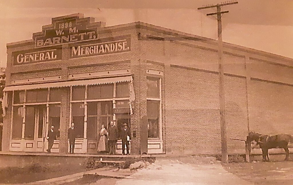
1898 | W.M. | Barnett | General Merchandise – In 1898, The People’s Republic at Wasco and The Moro Leader, reported that Wilson M. Barnett had men working on the brick building to be used for his general merchandising establishment. Forty-four new buildings were erected in Wasco during the previous twelve months. Barnett fired his brick kiln and Mr. Hoover commenced burning 170,000 bricks; 120,000 of them were for construction of W. M. Barnett’s new store. Photo from the City of Wasco Centennial Calendar
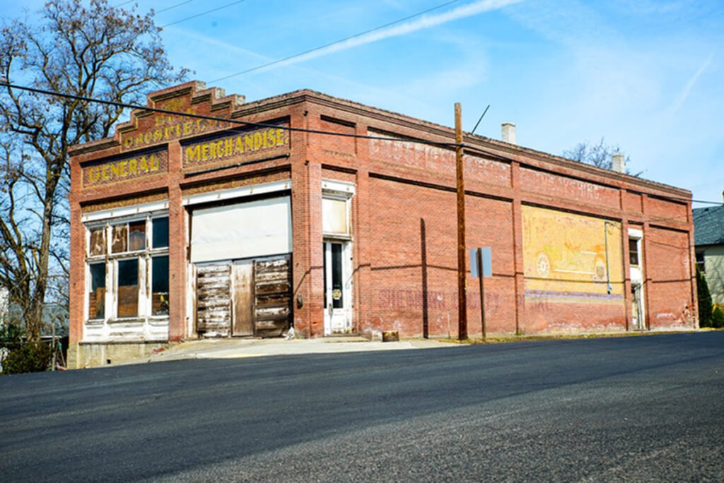
CROSFIELD GENERAL MERCHANDISE – George N. Crosfield (1870-1929) was born in West Virginia and came to Oregon when 18 years old and soon became identified with the farm machinery business. He established himself in business at Grant and Wasco about 1897 and for 35 years he was interested in every enterprise that would result in the social and business advancement of Sherman County. When Wasco was incorporated in 1898, he was elected the first mayor. Photo courtesy of Dave Bergmann, 2008.
“CROSFIELD GENERAL MERCHANDISE | CROSFIELD SELLS EVERYTHING.” Photo courtesy of Jeremy Lanthorn
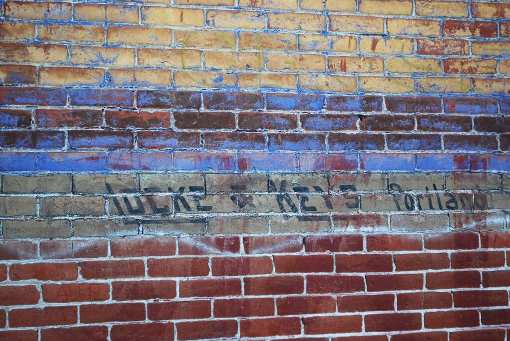
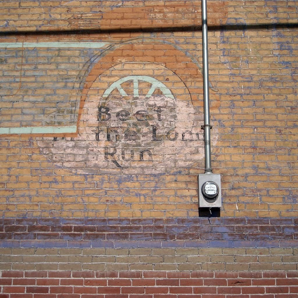
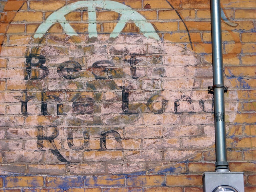
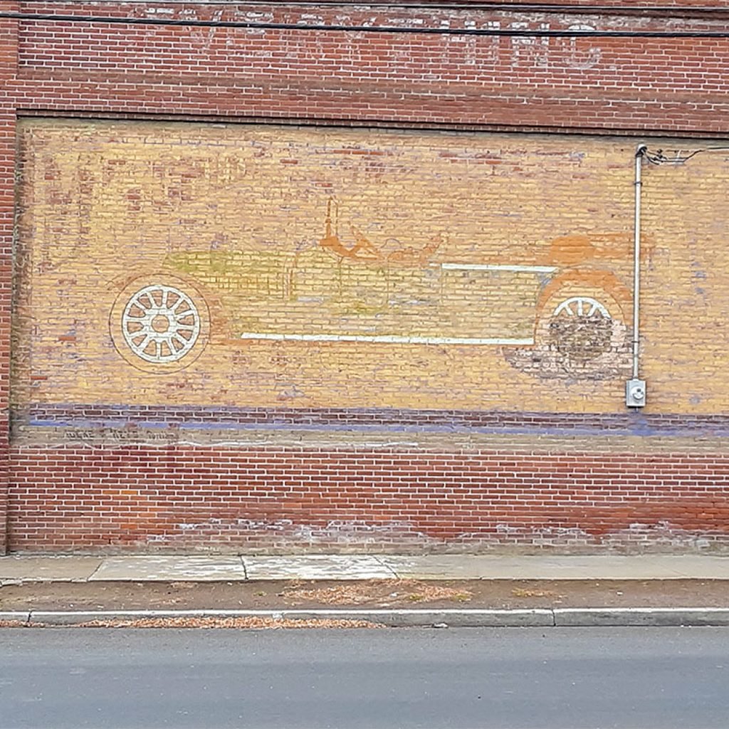
“Best in the Long Run” details and Locke & Keys Portland. Photos courtesy of Dave Bergmann, 2008. (It is unknown if Locke & Keys in Portland painted these images or were advertising their work when they put locks on the building.)
Marathon oil and gas, Goodrich tires and several auto makers used the slogan “Best in the Long Run.” The letter M is visible at the upper left in the front of the car. Marathon sold industrial oils and greases, dust absorbing, wetting and binding compositions, fuels and illuminants.


“SHERMAN COUNTY” is visible on the east side; it’s followed by another word beginning with P and ending with AL. Or maybe there’s a faint S before the brick column making it “SHERMAN COUNTY SPECIAL.” Photos courtesy of Dave Bergman and Carol MacKenzie.

An ad on the west side featured Monopole, THE BEST CANNED & GLASS FOODS. Photo by Susan Brown.
Heritage & Monuments
By Sherry Kaseberg
Photos by the author or as credited.
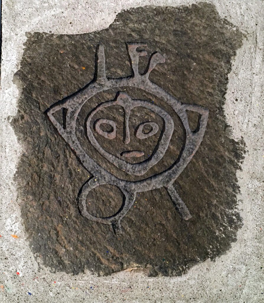
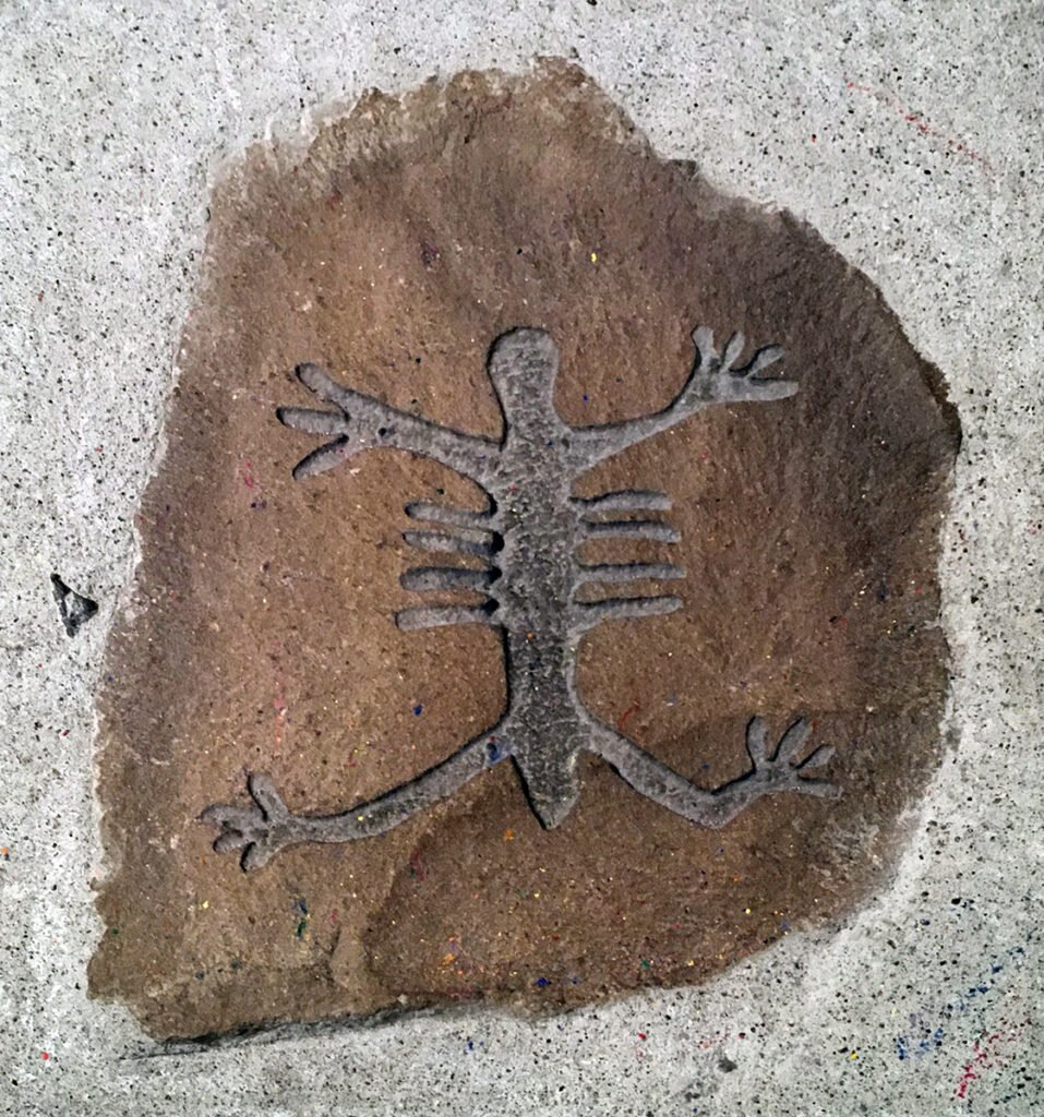
Pictographs and Petroglyphs
Petroglyphs are images created by carving into rock. Pictographs are created by painting on the rock surface.
Sherar’s Bridge

Native American images on Sherar’s Bridge, crossing the Deschutes River between Sherman County and Wasco County.
Oregon Trails, Rails and Roads in Sherman County.
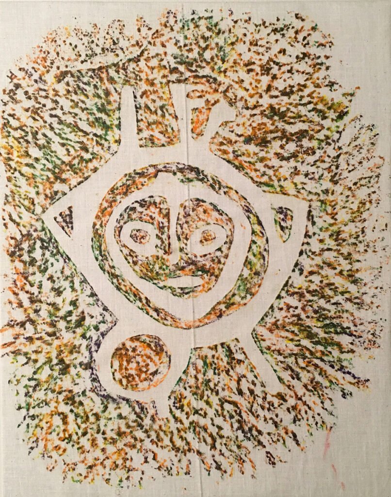

Visitors at the Sherman County Historical Museum learn about petroglyphs while making crayon rubbings of replicas of rock art designs in an exhibit, Oregon Trails, Rails and Roads in Sherman County.
The Oregon Trail – A Long Rocky Hill


“A Long Rocky Hill” on the west side of the John Day River.
A bronze plaque reads, “1843 – Old Oregon Trail Ford of the John Day River – 1863 | Emigrants on the old Oregon Trail forded the John Day River near this spot from 1843 to 1863. Thomas Scott established a ferry near here in 1858. Daniel Leonard built a bridge hear here in 1866. Thousands of settlers passed this way until the completion of the railroad in 1884. Land donated by Agnes Merritt.”
The Bureau of Land Management and volunteers constructed the shelter and interpretive signs next to the Society’s Oregon Trail monument in 1993. An Oregon Trail Sesquicentennial project, interpretive signs describe the descent to the John Day River and “A Long Rocky Hill” up the west side.
Photos courtesy of the Sherman County Historical Society.
An Inscribed Basalt Column

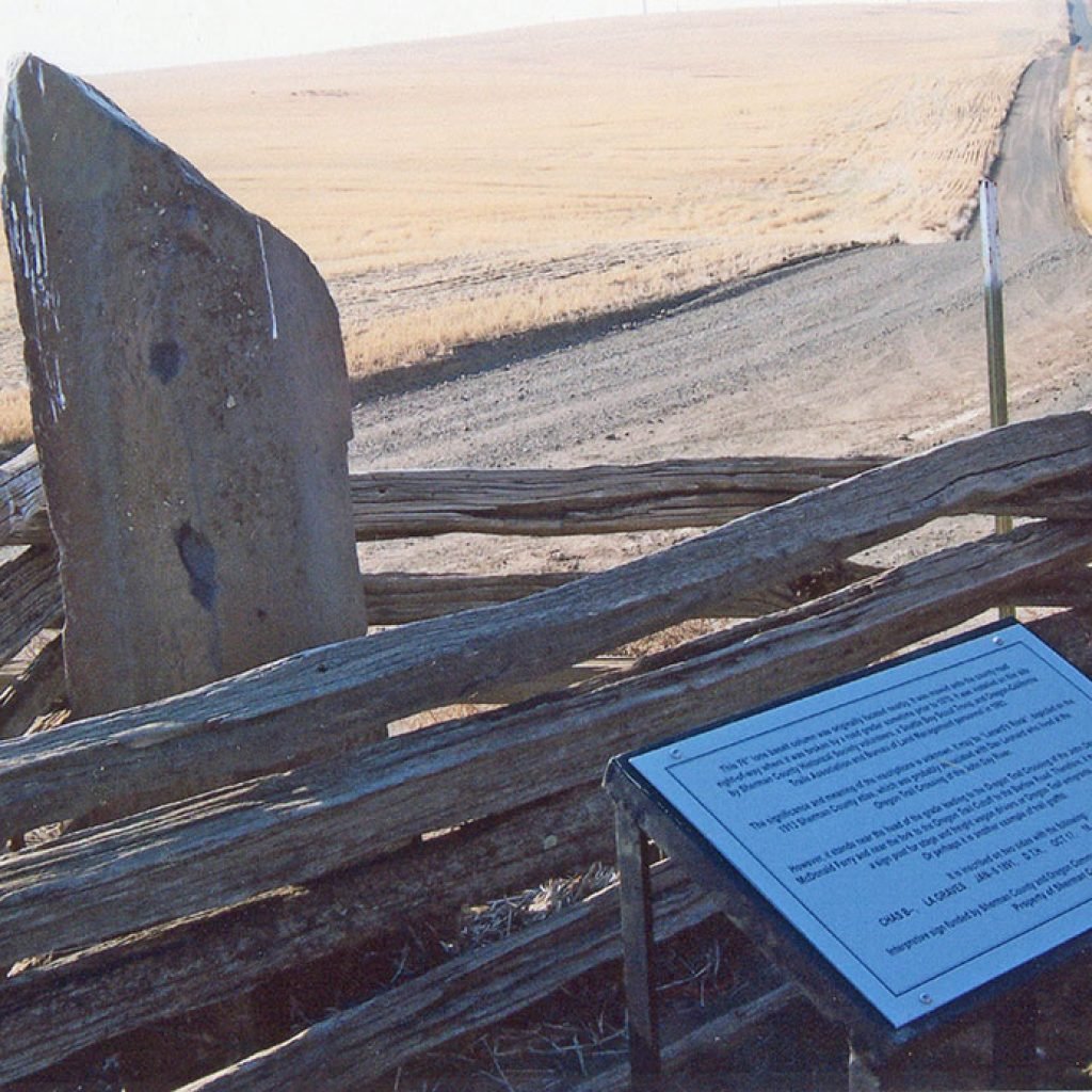
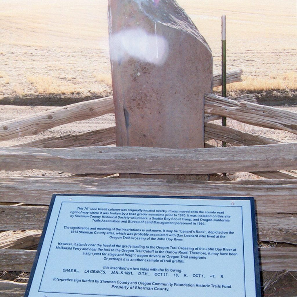
A six-foot inscribed basalt column, located near the fork in the Oregon Trail and about 1 ½ miles west of the John Day River at McDonald, was the subject of research and restoration by Bureau of Land Management and Oregon-California Trails Association in 1992. It was permanently installed near its original site in June, 1993, by Pat Macnab, Millard Melzer, Pat Kelley, Roland Simantel, Herb Ramsey, Rick Jauken and Seattle Boy Scout Troop #570 of Kirkland, Washington.
Inscriptions found on the basalt column in 1970: “CHAS BO… LA GRAVES… OCT 1… JAN__S… D.T.H…. OCT 17… 18…” and two initials, “R” as well as some dates. Vandals have since left their marks. Property of Sherman County. Photos courtesy of the Sherman County Historical Society.
Oregon Trail Route signs

An Oregon Trail route sign is part of a Sherman County Historical Museum exhibit, Oregon Trails, Rails and Roads in Sherman County. Photo courtesy of the Sherman County Historical Society.
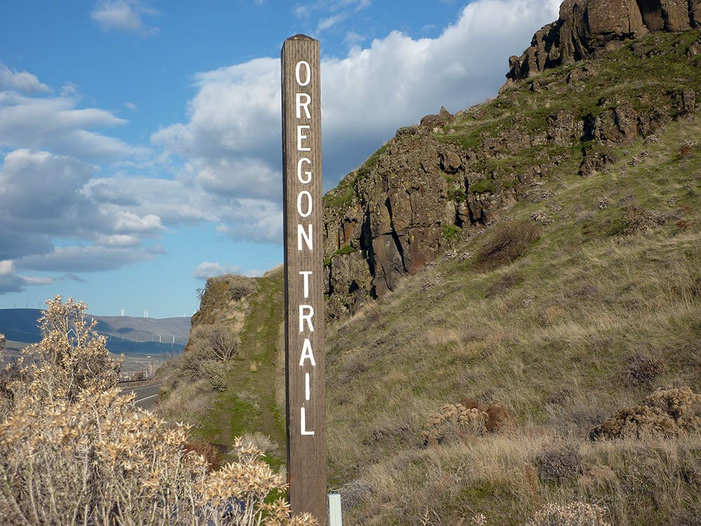


Highway 30 at the Oregon Trail monument west of Biggs on the Columbia River. Photos courtesy of Sherry Kaseberg
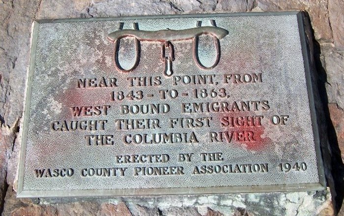
“Near this point from 1843 to 1863, west bound emigrants caught their first sight of the Columbia river. Erected by the Wasco County Pioneer Association 1940.” Photo courtesy of Sherry Kaseberg
Oregon Trail crossing of Spanish Hollow on Highway 97.

In 1980, Sister Krista von Borstel crafted this Oregon Trail sign for the Wasco Women’s Study Club led by Marguerite Kaseberg and Catherine (Richelderfer) Bish. It marked the Oregon Trail crossing of Spanish Hollow on Highway 97. In 2019, it was stolen!
The Dalles Military Road
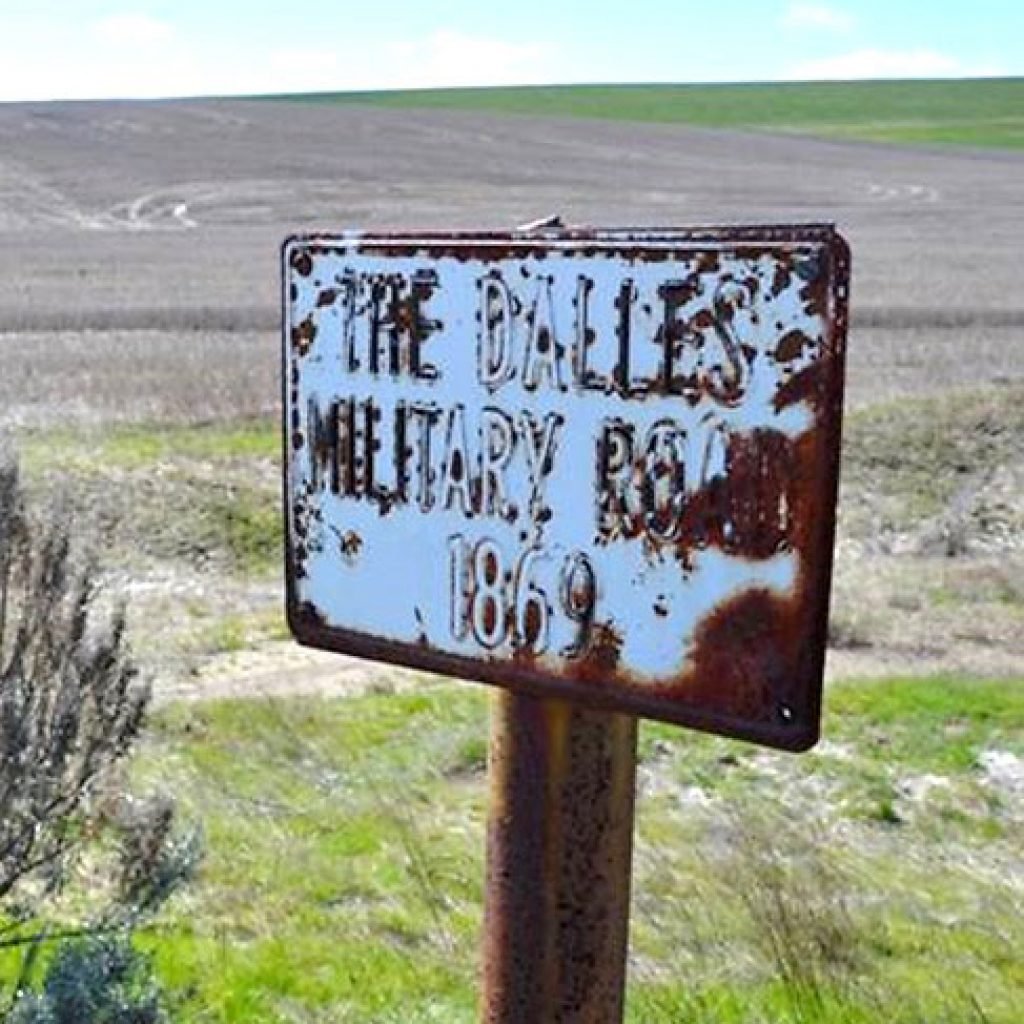
In 1959, the Sherman County Historical Society purchased 12 signs to mark the route of “THE DALLES MILITARY ROAD 1869” through Sherman County. Photo courtesy of Michael Peroni
The Journey Through Time Scenic Byway

The Journey Through Time Scenic Byway begins at Biggs, along the Columbia River, and curves up US-97 between the canyons of two more major Oregon rivers, the Deschutes and the John Day. The skies here seem huge and the views stretch for miles, with checkerboard wheat fields, undulating golden hills and spinning wind turbines. ~ Travel Oregon
Biggs, Oregon
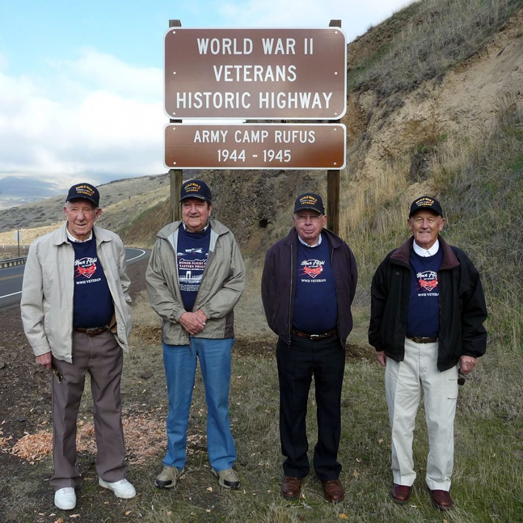
Veterans Dewey Thomas, Pete Macnab, Charles Decker and Donald Thompson were on hand for the dedication of the Army Camp Rufus sign on Highway 97 near Biggs in 2012. Photo courtesy of the Sherman County Historical Society.
Grass Valley, Oregon
Oregon Trail Cutoff to Barlow Road sign

The sign reads, “Samuel K. Barlow established a wagon road in 1846 from The Dalles across the Cascade Range. Oregon Trail emigrants preferred the new road to the perilous Columbia River route, which had claimed many lives. The Barlow Road allowed emigrants to drive wagons to the Willamette Valley for the first time.”
“By 1848 many over-landers left the Oregon Trail soon after crossing the John Day River on a Cutoff to the Barlow Road through what is now Sherman County. Although emigrants complained of a scarcity of water and firewood, the trail was relatively easy until the canyon of the Deschutes. Riley Root made the trek in 1848; he described the ordeal as ‘almost as difficult of descent and ascent as the valley of Sinbad the sailor, with nearly precipitous rocks, from 1000 to 1500 feet high on every side…’ The balance of the Barlow Road across the Cascade Range was equally arduous.”
“Despite the difficulties, Barlow’s Road was a success – and the Cutoff to the Barlow Road shortened the distance to settlements in the Willamette Valley even more. This ‘shortcut’ also contributed to the settlement of Sherman County which later became known as the ‘Golden Land’ because of its fields of golden grain.”
Our public art reflects and reveals local culture. It adds meaning and uniqueness to our communities as we discover connections between past, present and future.
Kent, Oregon
Artistry in rock


Justesen Ranch corral. Photos courtesy of Fred Justesen
Moro, Oregon
Moro City Park – Moro, Oregon

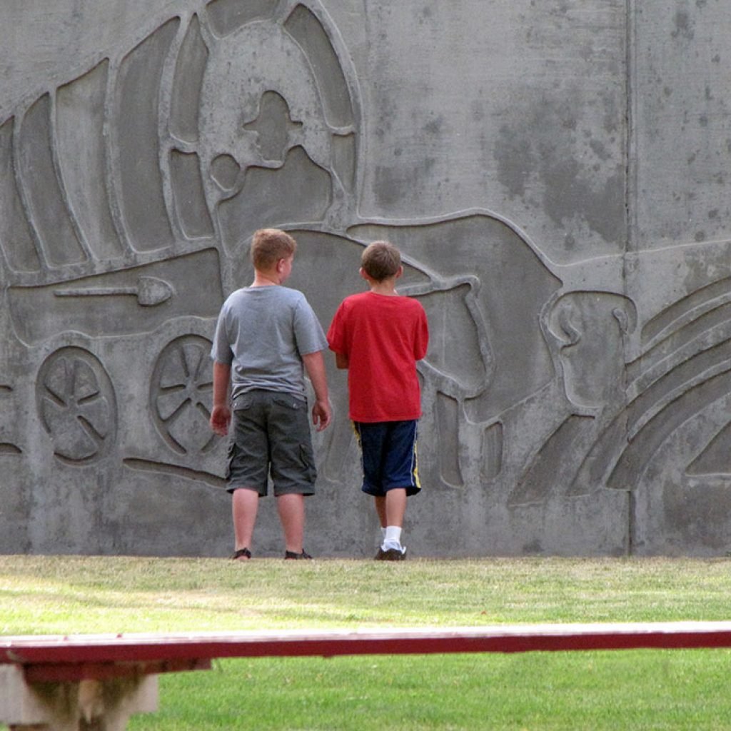


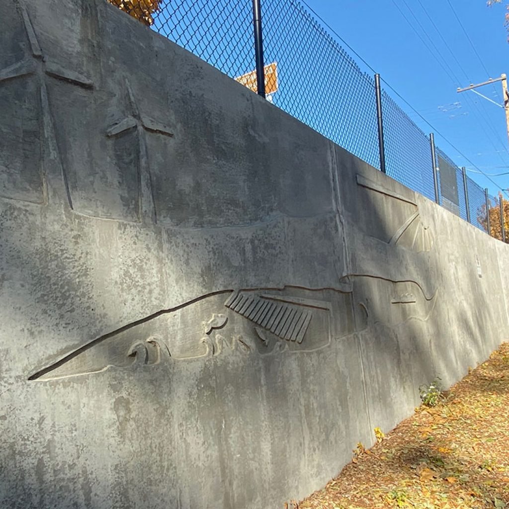


This contemporary take on Sherman County history stretches along the Moro City Park wall between 2nd and 3rd Streets and below Main St. (Hwy 97).
The Oregon Department of Transportation and the City of Moro collaborated with the Sherman County Historical Society on the concrete relief mural designed by Pat Jacobsen. Dale Coles and Larry Triebelhorn, Moro City councilors, fabricated the concrete forms.
Sherman County Public/School Library
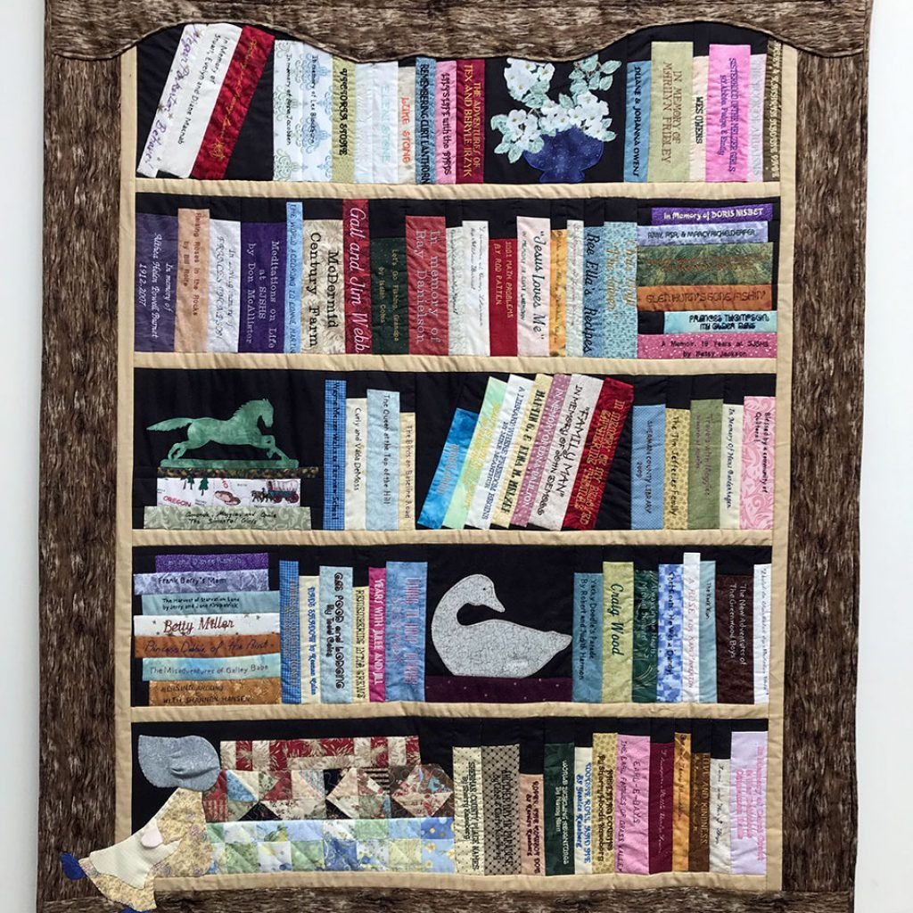
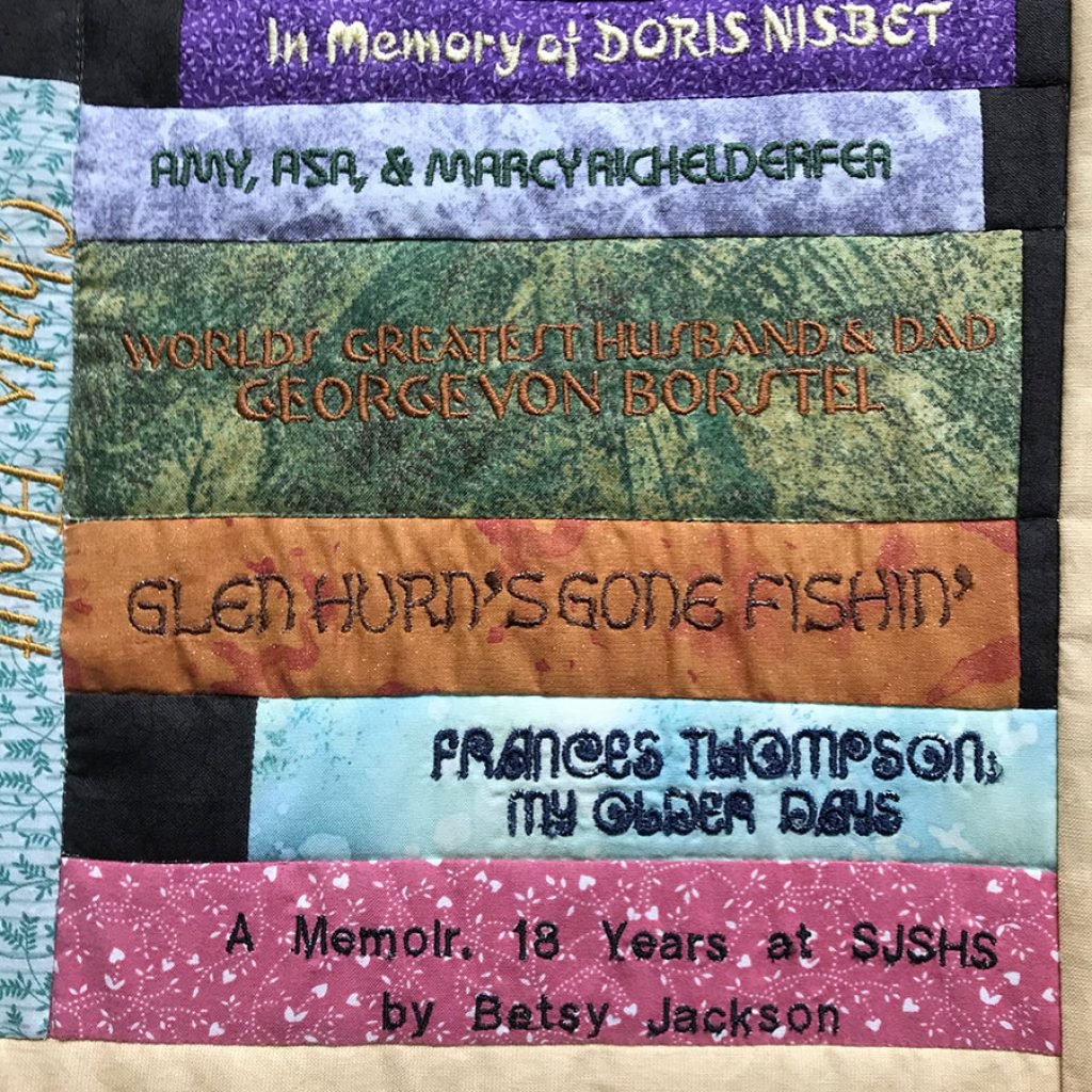
The library wall hanging presented on March 14, 2009, commemorates the opening of the Sherman County Public/School Library. It was quilted and embroidered by Penny Eakin, Martha Flatt, Orice Klaas, Carol Mackenzie, Mavis Olsen, Delores Richter, Lisa Shafer, Emma Jean Smith, and Gladys Wesley. Photos courtesy of Marylou Martin.
Sherman County Historical Museum

The Sherman County Historical Society seal designed by Theodore Johnston was created by Krista von Borstel. Photo courtesy of the Sherman County Historical Society.
1989 Centennial Quilts
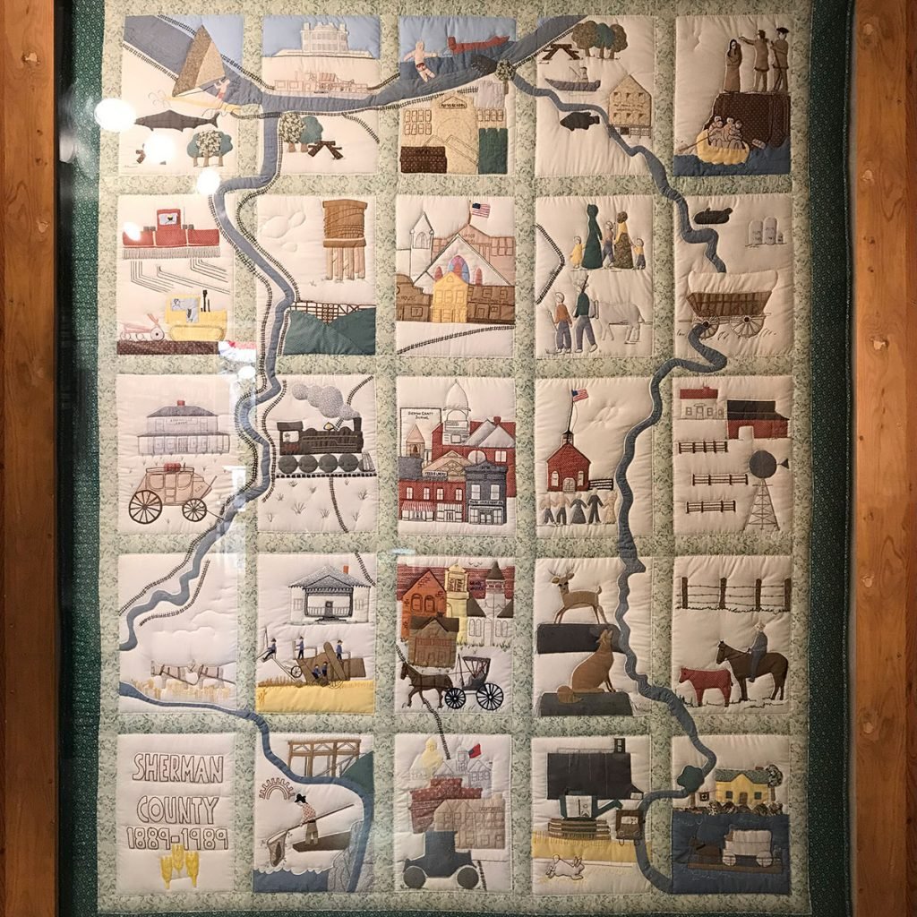
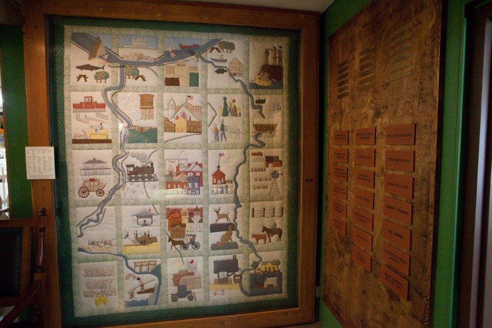
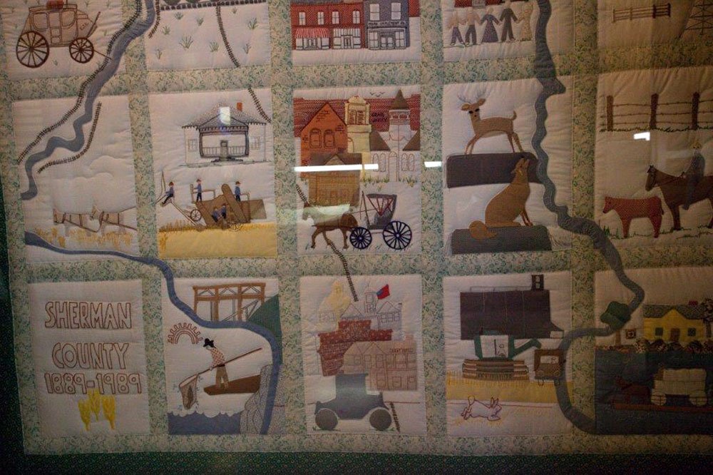
The two 1989 Centennial Quilts designed by Sherry Kaseberg, From Bunch Grass to Golden Grain, is the work of quilters and embroiderers: Mary Anderson, Lula Beckwith, Dorothy Benson, Marion Boynton, Joyce Brown, Sheri Carlson, Joyce Clodfelter, Kate Grant Coats, Reatha Coats, Doris Coelsch, Dorothy Coons, Marie Cyphers, Dee DeMoss, Ethel Eakin, Penny Eakin, Carol Eaton, Marie Hattrup, Betty Henrichs, Denise Holzman, Doris Hubbard, Keely Jefferies, Judy Justesen, Mary Ann Justesen, Donna Kaseberg, Margilee Kaseberg, Darla King, Linda Krafsic, Helen Leff, Sue Lissman, Gail Macnab, Cathie Martin, Helen Martin, June Jefferies McAfee, Owietus McDermid, Shirley Miller, Pat Mobley, Millie Moore, Rose Moore, Dorothy Olsen, Nancy Reed, Beth Reid, Shawn Roberts, Mavis Olsen, Florene Schilling, Rhonda Shelton, Emma Jean Smith, Margaret Snider, Frances Thompson, Diane von Borstel, Linda von Borstel, Anne Wilson and Arlene Winn.
DeMoss Springs Park


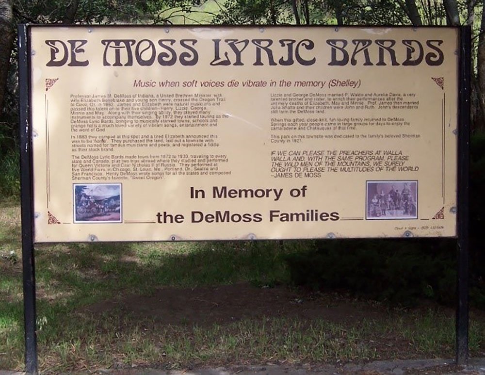

DeMoss Springs Park was dedicated as a park in 1897 by the DeMoss family and deeded to Sherman County in 1921. The county’s only park, a shady wayside on Highway 97, was placed on the National Register of Historic Places in 2006.
Rufus, Oregon
The Rufus Pioneer Cemetery
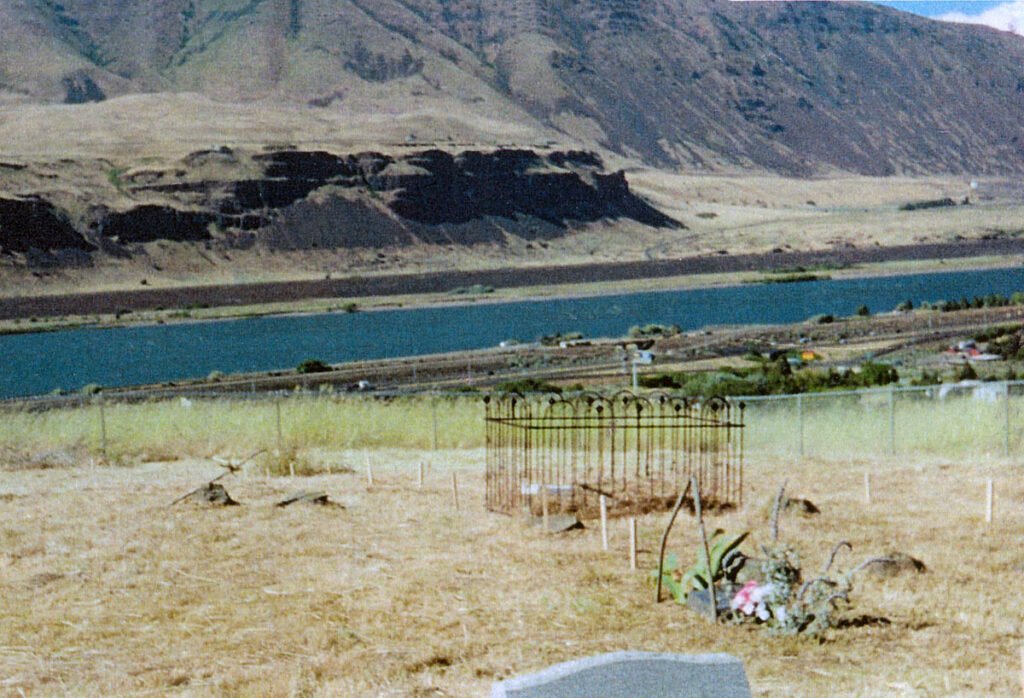
This small cemetery on private property on the hill south of Rufus, T2N, R17E, SW ¼ of NE ¼, Section 6, offers a spectacular view of the Columbia River.
In 1997, Joe Mee took it upon himself to preserve this little cemetery. He determined that the size of the cemetery would be 100’ x 120’, as otherwise identified in a survey performed 29 October 1987 by Tenneson Engineering in The Dalles, without exact start and ending corners. Joe estimated the metes and bounds to the best of his ability and staked the corners for the fencing contractor. The Charles Athay family, recorded owners of the property, refused to respond to Joe Mee’s attempts to gain permission for fencing, and he proceeded without it. His grandmother, Daisy May Young Mee, is one of those buried there. He established Pioneer Cemetery status with the State of Oregon.
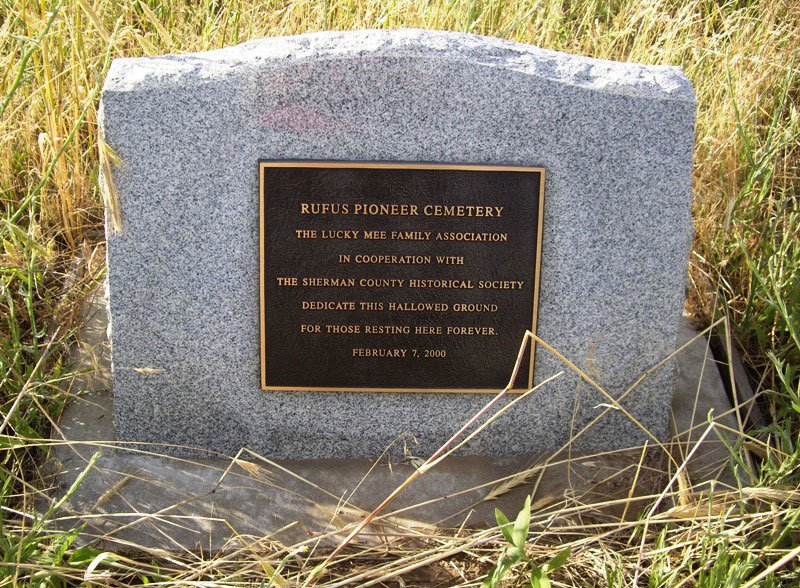
In February 2000 Rufus Pioneer Cemetery was dedicated by Joseph Mee as a Pioneer Cemetery per House Bill 3378, regarding burial places with remains of one or more persons who died before February 14, 1909. After a short dedication ceremony with Rufus Mayor Cliff Jett and Sherry Kaseberg, Joseph Mee installed the cemetery sign. He paid for the construction of a 100’ x 120’ chain link fence around the Cemetery and installed a permanent marker and a sign on the fence to preserve this historic site, believing at the time that at least 16 persons are buried there. Ownership in 2017: Gorge Vista, LLC.
Photos courtesy of Joseph Mee
WWII Camp Rufus
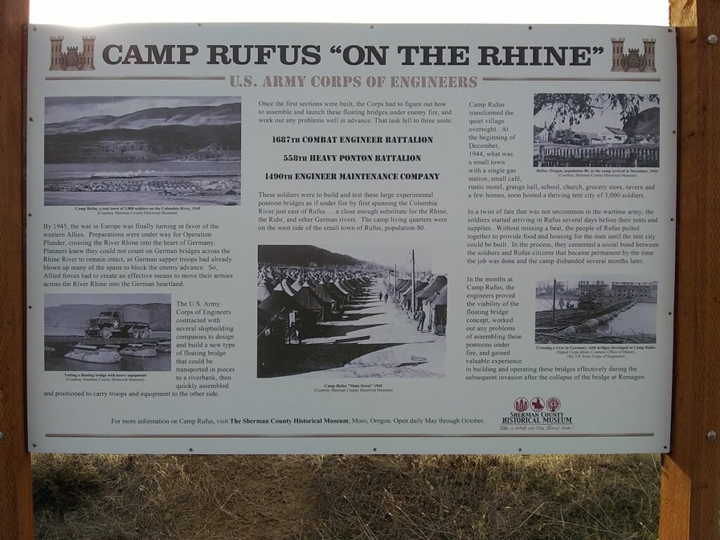
On December 22, 1944, the Sherman County Journal reported that about a thousand men of the 1687 Combat Engineers Battalion, the 558 Heavy Pontoon Engineers, and the 1490 Engineer Maintenance Company were encamped near the small town of Rufus, about twenty-two miles east of The Dalles. At Camp Rufus, one of several temporary military camps in Oregon during World War II, tents were set up, and trucks, jeeps, tanks, and pontoon bridging sections arrived for testing on the Columbia and on the nearby Deschutes River.
The town opened the grange hall, the school, and the church to the men, and the local chapter of the Red Cross asked residents to provide cookies, newspapers, magazines, and books. Families were urged to invite soldiers to their homes, and some romances developed. Local resident Curtis A. Tom was camp instructor for first aid and water safety. At its peak, the population of the camp was about twenty-five hundred men.
During World War II, Oregon was strategically important in defending the West Coast from Japanese attacks. Observation units were stationed along the coast, north-south highways were defined as defensive lines, and private flights were prohibited west of the Cascade Mountains. Several training facilities similar to Camp Rufus were established east of the Cascades.
On April 13, 1945, the Journal reported that the soldiers had departed, leaving the site of Camp Rufus bare with sand blowing in the wind. A few days later, on April 20, the paper reported a connection between the army engineers stationed at Camp Rufus and a proposed bridge over the Rhine River. The Rufus engineers had experimented with pontoon, or floating, bridges and had designed the bridge using specifications developed by the Kaiser Shipyards in Portland. The key bridge over the Rhine was not destroyed in the war, however, so the new bridge was not needed.
In 2012, the World War II Veterans Historic Highway Committee, under the leadership of Dick Tobiason, installed signs on U.S. Highway 97 and State Road 126 to honor World War II troops who had trained at Camp Rufus, the Madras Army Airfield, the Redmond Army Airfield, the Civilian Pilot Training camps at Bend and Prineville, Camp Abbot at Sunriver, and the Marine Barracks and Naval Air Station at Klamath Falls.
Photo courtesy of Aaron Cook.
Wasco, Oregon
Columbia Southern Railway Passenger Station and Wasco Railroad Depot


“To Biggs 9.6 M | Wasco | Elevation 1270 Feet | To Shaniko 60.2 M.”
The Columbia Southern Railway Passenger Station and Freight Warehouse is listed on the National Register of Historic Places. Rails were laid from Biggs to Wasco in 1897, and extended to Moro in 1899 and Shaniko in 1900. Photos courtesy of Dave Bergmann
Sun Rise Cemetery


Sun Rise Cemetery’s unique turnstile, at the left of the driveway, consists of a black post with revolving horizontal bars to allow access for people but not horses or cattle.
Public Art in Sherman County
Businesses & Organizations
By Sherry Kaseberg with Chris Sanders
Photographs by the author and as credited.
Businesses and organizations help people form a sense that this places is unique, that there’s something special about it. Their signs and logos influence our emotions, thoughts, and actions.
Grass Valley, Oregon
Diamond Circled Stock Ranch

“The home of purebreds. Shorthorn CATTLE. Hampshire HOGS. DIAMOND CIRCLED STOCK RANCH. Phone 499. Millard R. & Oma L. Eakin – Owners | Grass Valley – Sherman Co. – Oregon.” The sign was painted by Dick Null (siged at center bottom). Photo courtesy of Jean Luxford Hulbert
There are two distinct languages. There is the verbal which separates people… and there is the visual that is understood by everybody.
Yaacov Agam
John Day River
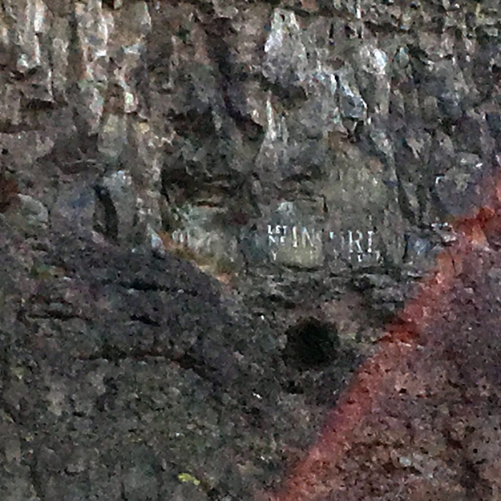
On a basalt wall in Cottonwood Canyon is historic lettering that reads, “LET ME INSURE YOUR HORSE.” Photo courtesy of Michael Peroni.
Moro, Oregon
Sherman County Public/School Library
The Sherman Public Library logo, designed by Abbey Phelps.
Elrod and Moore Real Estate & Sherman Trading Company
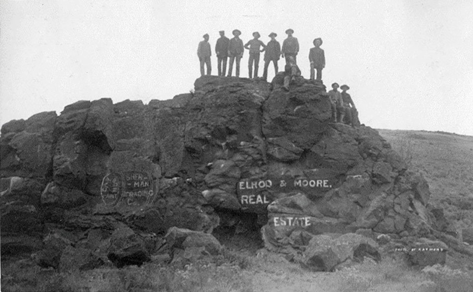
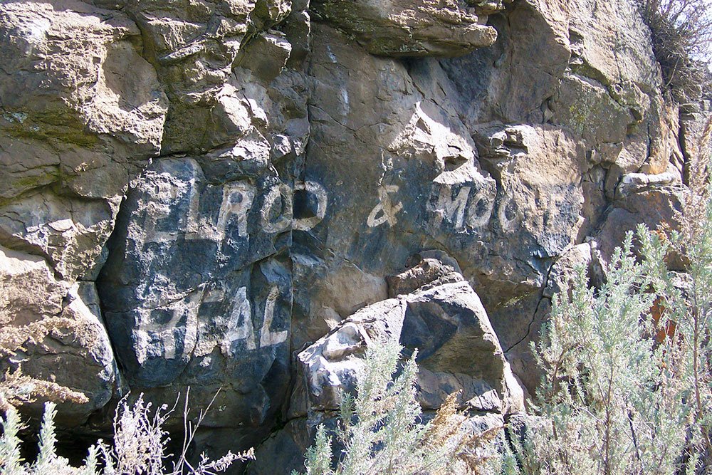

Lone Rock in Grass Valley Canyon is located at the junction of Lone Rock Road and Coelsch Road. It served as a billboard for local real estate developers Elrod and Moore. Photographer Will Raymond was on hand with local businessmen and, perhaps, the artist who applied the paint. Or was Raymond the sign painter?
The words “ __ __ PAINT” and “SHER-MAN TRADING CO.” are visible left of Elrod & Moore. Articles of Incorporation for Sherman Trading Co. are dated June 5, 1901.
Photos courtesy of the Sherman County Historical Society.
Lisa’s in Stitches
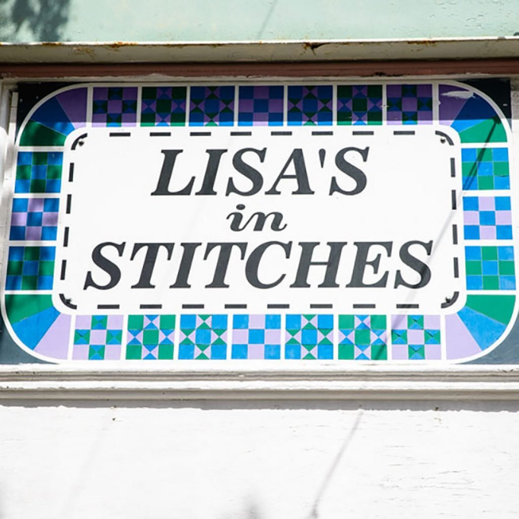
Artist and quilter Lisa Shafer operated her business on Main Street in Moro. Photo courtesy of Jeremy Lanthorn
Nell’s Shop Door on Main Street
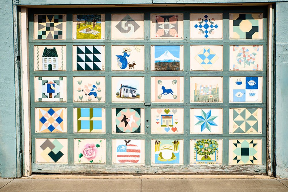


Moro Community Presbyterian Church quilters and friends decorated the overhead door on Nell Melzer’s shop door in Moro.
A small sign reads, “Sampler Quilt. Space, materials and artists’ work were volunteered and donated! Artists… Penny Eakin, Thad Eakin, Tate Eakin, Teri Bickler, Kyle Bickler, Shawn Bickler, Myrna Melzer, Deana Martin Padget, Amy Earl, John Shafer, Lisa Shafer, Travis Shafer, Myles Shafer, Katherine Shafer, Orice Klass, Millie Voll, Sheila Weber, Dorothy Thompson, Carol MacKenzie, Ktie Wooderson, Pat Jacobsen, Brooke Gray, Shirley Fritts, Dawn Lohrey, Jenny McAllister, Bev McAllister, Nancy Kivett, Mary Lou Dennis, Mary Jo Lane, Carmen, M___ and Co__ ____; script by Patty Burnet and Deanna Padget; carpentry by Andy and Jordan Anderson and Susan Dennis.”
Photos courtesy of Jeremy Lanthorn
Sherman County Historical Museum
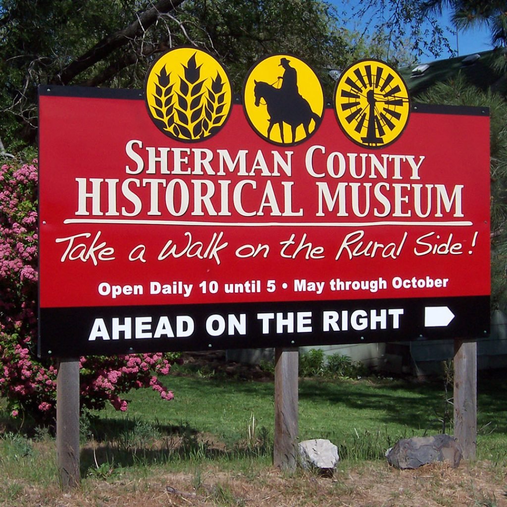
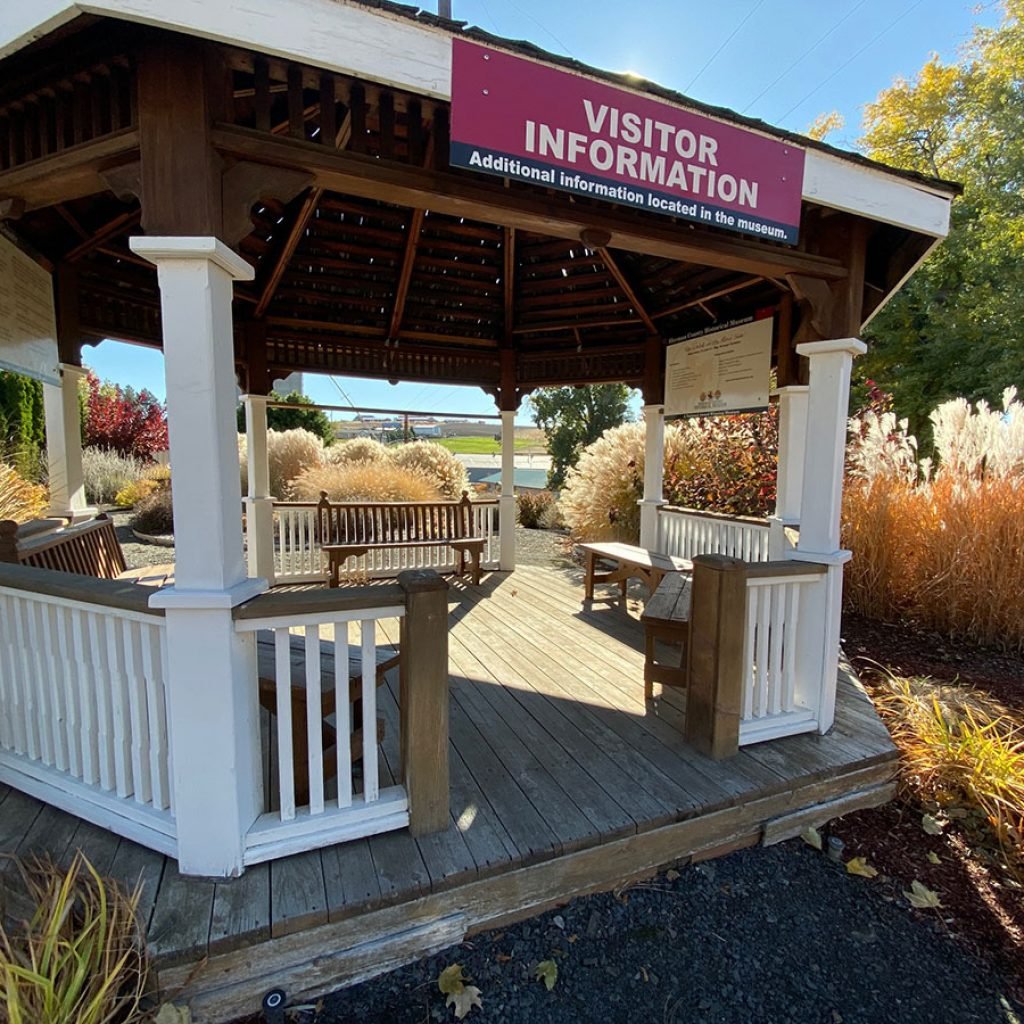
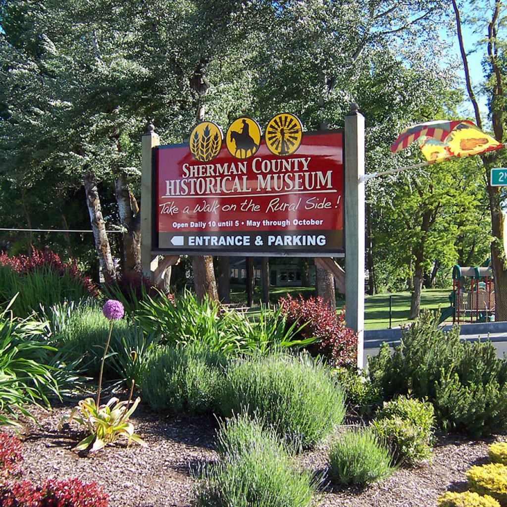
The Sherman County Historical Society operates the Oregon Visitor Information Center in the museum and provides visitor information inside this kiosk in Moro. The society/museum logo and signage were designed by Cameron Kaseberg. Photos courtesy of the Sherman County Historical Society.
Mid Columbia Producers logo
Mid Columbia Producers, Inc. (MCP) is a farmer-owned cooperative formed in 1988 when two neighboring co-ops were merged, combining operations dating back to the 1930s. MCP operates grain storage and marketing facilities in Sherman, Wasco, Gilliam, Morrow and Klickitat counties and offers a wide variety of wheat, barley and forage seed. The petroleum division offers commercial, agricultural and residential bulk fuel, lubricant, and heating oil deliveries and consumer and commercial cardlock fuel sites. MCP’s retail farm store in Wasco provides hardware, livestock, fencing, garden and home supplies.
Rufus, Oregon
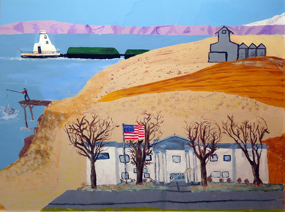
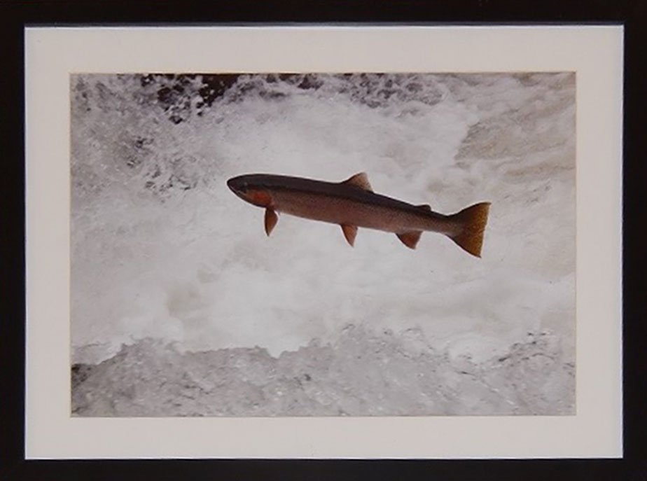
Preacher’s Eddy Fishing Platforms
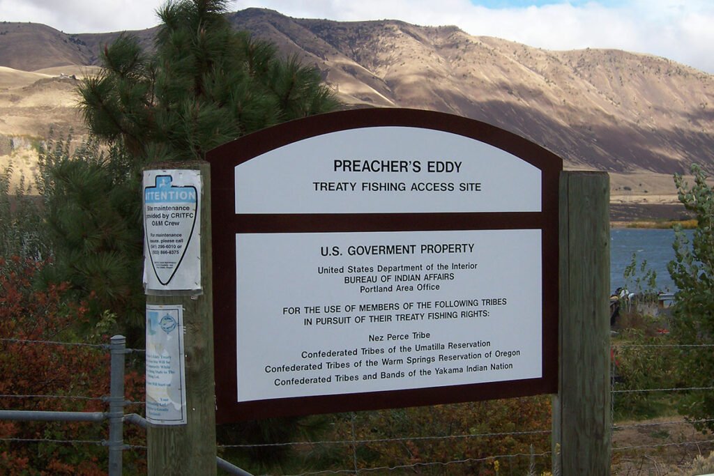

An historic cultural site at Columbia River mile 214 near Rufus, Preacher’s Eddy is one of several In-lieu Treaty Fishing Access sites reserved for the four Columbia River Treaty tribes, Nez Perce, Confederated Tribes of the Warm Springs Reservation, Confederated Tribes and Bands of the Yakima Nation and Confederated Tribes of the Umatilla Reservation. A public boat ramp provides access to sites favored for walleye fishing.
Wasco, Oregon
Barnett-Crosfield General Merchandise
1898 | W.M. | Barnett | General Merchandise – In 1898, The People’s Republic at Wasco and The Moro Leader, reported that Wilson M. Barnett had men working on the brick building to be used for his general merchandising establishment. Forty-four new buildings were erected in Wasco during the previous twelve months. Barnett fired his brick kiln and Mr. Hoover commenced burning 170,000 bricks; 120,000 of them were for construction of W. M. Barnett’s new store. Photo from the City of Wasco Centennial Calendar
CROSFIELD GENERAL MERCHANDISE – George N. Crosfield (1870-1929) was born in West Virginia and came to Oregon when 18 years old and soon became identified with the farm machinery business. He established himself in business at Grant and Wasco about 1897 and for 35 years he was interested in every enterprise that would result in the social and business advancement of Sherman County. When Wasco was incorporated in 1898, he was elected the first mayor. Photo courtesy of Dave Bergmann, 2008.
“CROSFIELD GENERAL MERCHANDISE | CROSFIELD SELLS EVERYTHING.” Photo courtesy of Jeremy Lanthorn
“Best in the Long Run” details and Locke & Keys Portland. Photos courtesy of Dave Bergmann, 2008. (It is unknown if Locke & Keys in Portland painted these images or were advertising their work when they put locks on the building.)
Marathon oil and gas, Goodrich tires and several auto makers used the slogan “Best in the Long Run.” The letter M is visible at the upper left in the front of the car. Marathon sold industrial oils and greases, dust absorbing, wetting and binding compositions, fuels and illuminants.
“SHERMAN COUNTY” is visible on the east side; it’s followed by another word beginning with P and ending with AL. Or maybe there’s a faint S before the brick column making it “SHERMAN COUNTY SPECIAL.” Photos courtesy of Dave Bergman and Carol MacKenzie.
An ad on the west side featured Monopole, THE BEST CANNED & GLASS FOODS. Photo by Susan Brown.
Huck’s Garage

Caesar Huck (1847-1921) came to America about 1872, spent a few months in Iowa and a few years in Dixon, California, where he married Louisa Hanke. They arrived in Sherman County in 1884 and acquired farm land north of Wasco. Their children were John C., Herman H., Mary A., Charles W., Anna, Bertha, Lucy, Hazel and Bill who married Bessie Porter. Herman was a farmer, Charlie a mechanic and Bill a businessman. Perhaps Huck’s Garage in Wasco was Charlie’s. Photo courtesy of Dave Bergmann
Sazerac the Rooster

Dave Bergmann and Lisa D’Arcy, owners of the Wasco House Bed and Breakfast, bought the old O’Meara milking barn property with a chicken coop which they use to house hens for egg production for their B&B. They found Sazerac the rooster at a country antique store in Joseph, Oregon. Photo courtesy of Dave Bergmann
McKee’s Pharmacy
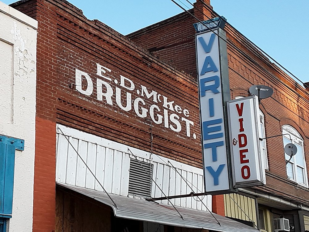
Edward D. McKee (1873-1966) was the second druggist in Wasco when he opened the Wasco Pharmacy in 1899 and operated it until his retirement about 1953. Afterward the building housed a druggist and variety store. Active in civic affairs, he was serving as a county commissioner 1917. He married Mary Virgilia “Molly” Dunlap, the daughter of one of Wasco’s founding families, Clark and Nancy (Chapman) Dunlap, in Wasco in 1901, and they had a son and a daughter, Marion and Margaret. ~ Sherman County Journal, December 1, 1966. Photo courtesy of Dave Bergmann.

E.D. McKee, Druggist, Wasco Market, U.S. Post Office and former café at left. Photo courtesy of Jeremy Lanthorn
Edward D. McKee (1873-1966) was born at McKee Station near Woodburn, Oregon. He came to Wasco and opened the Wasco Pharmacy in 1899 which he operated for 50 years. He served the school, city and county in elected capacities, including as county commissioner 1912-1918 and as county judge 1919-1931.
The Lean-to and Goose Pit Saloon
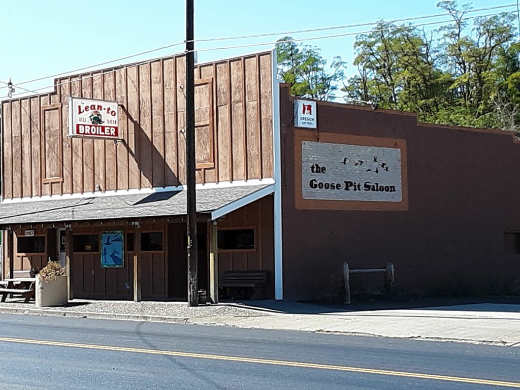
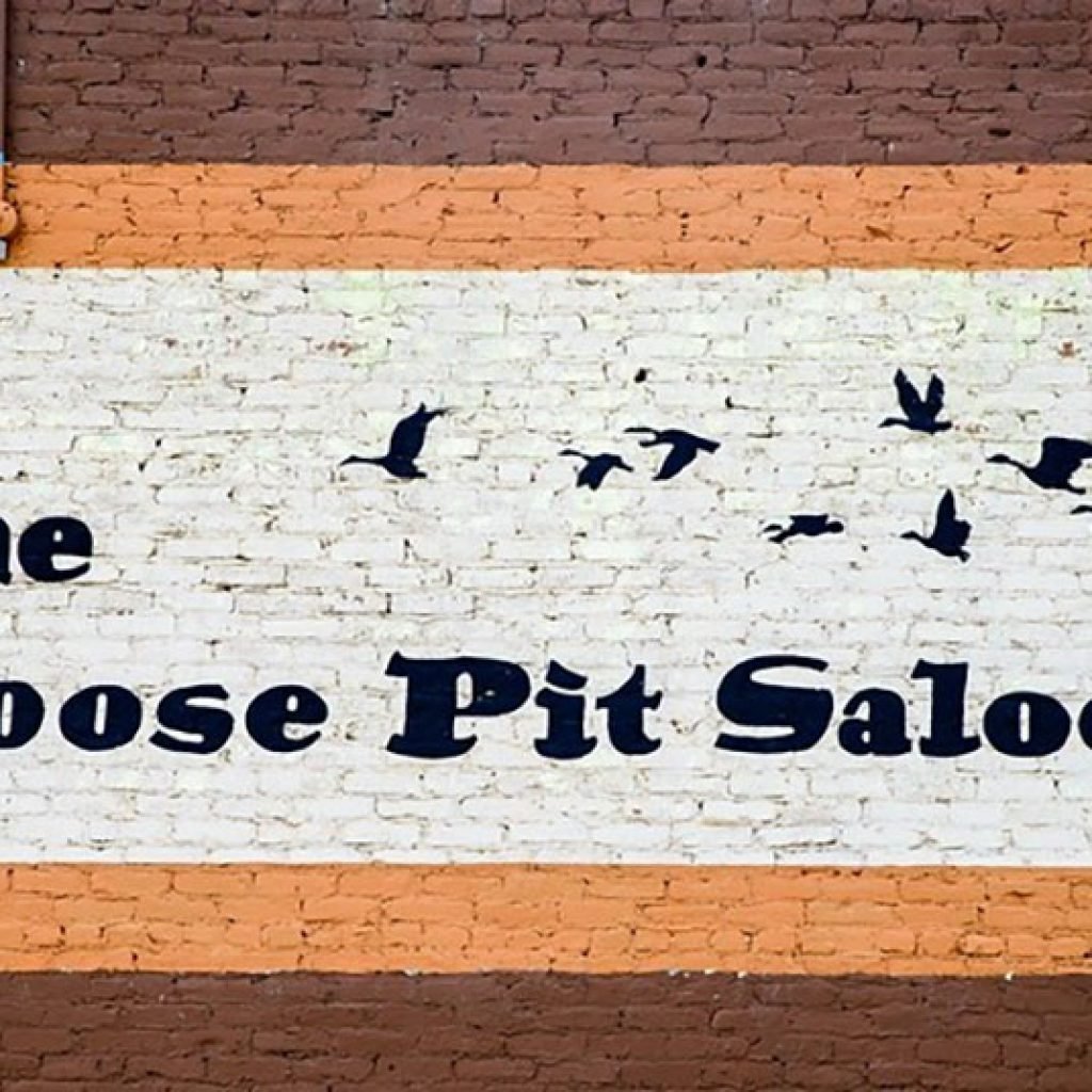
Joni Anderson painted the Goose Pit Saloon sign for proprietors, Mike Gutfleisch and Kathy Neihart. Photos courtesy of Dave Bergmann and Jeremy Lanthorn.
Sherman County Farm Chemicals

The logo for Sherman County Farm Chemicals in Wasco, a head of wheat with NH3, represents an agricultural fertilizer, ammonia, a colorless inorganic compound of nitrogen and hydrogen. Photo by Dave Bergmann.
Federal, State and Local Government
Creating art for public space is not a solitary process. The artist is asked to share a creative point of view and to collaborate with others. The result encourages a sense of shared ownership.
Biggs, Oregon
Spanish Hollow Bridge

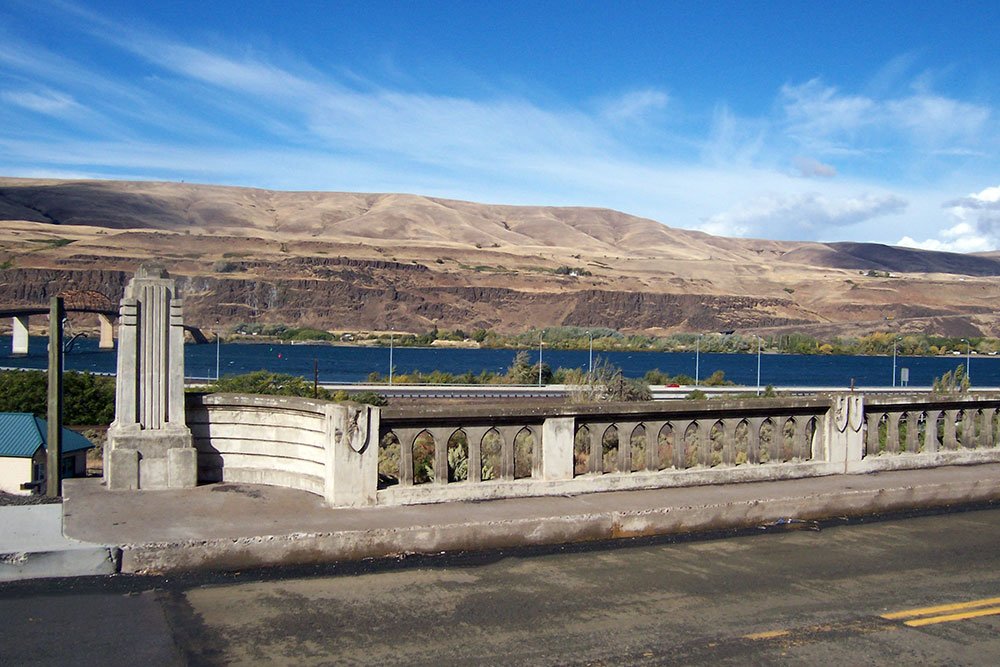
The Spanish Hollow Bridge is a concrete stringer bridge over Spanish Hollow Creek on the Biggs-Rufus Highway (Old U.S. 30) in Biggs, Oregon. Built in 1935 by Conde B. McCullough of Redfield, South Dakota (Bridge Engineer), it is an excellent example of a Conde McCullough era reinforced concrete stringer bridge. The bridge features many of the ornamentations seen during the McCullough era such as art deco pylons and aesthetically sensitive railing.
I-84 Highway overpass at Highway 97

Biggs Junction is an important wheat shipping point with grain storage elevators and facilities for shipping wheat by river barge and rail. Images of wheat on the I-84 overpass remind travelers that they are in wheat country. Oregon Department of Transportation and Sherman County Historical Society volunteers collaborated to make Pat Jacobsen’s design a reality.
Photo courtesy of Oregon Department of Transportation, CC BY 2.0 https://creativecommons.org/licenses/by/2.0, via Wikimedia Commons
“My goal as an artist is to create art that makes people look at the world in a different way.”
Autumn de Forest
Deschutes River, Oregon
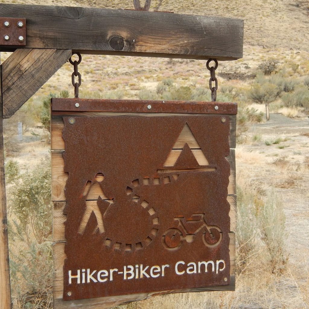
Deschutes River Recreation Area


The Deschutes River State Recreation Area is a park at the confluence of the Deschutes and Columbia rivers. The 35 acre park offers opportunities for camping, fishing, hiking, mountain biking, and equestrian trail riding as well as beautiful views. Photos courtesy of Ben Asmus.
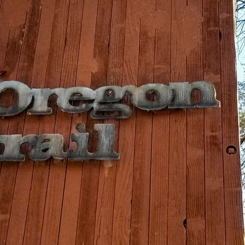
Oregon Trail Interpretive Kiosk.
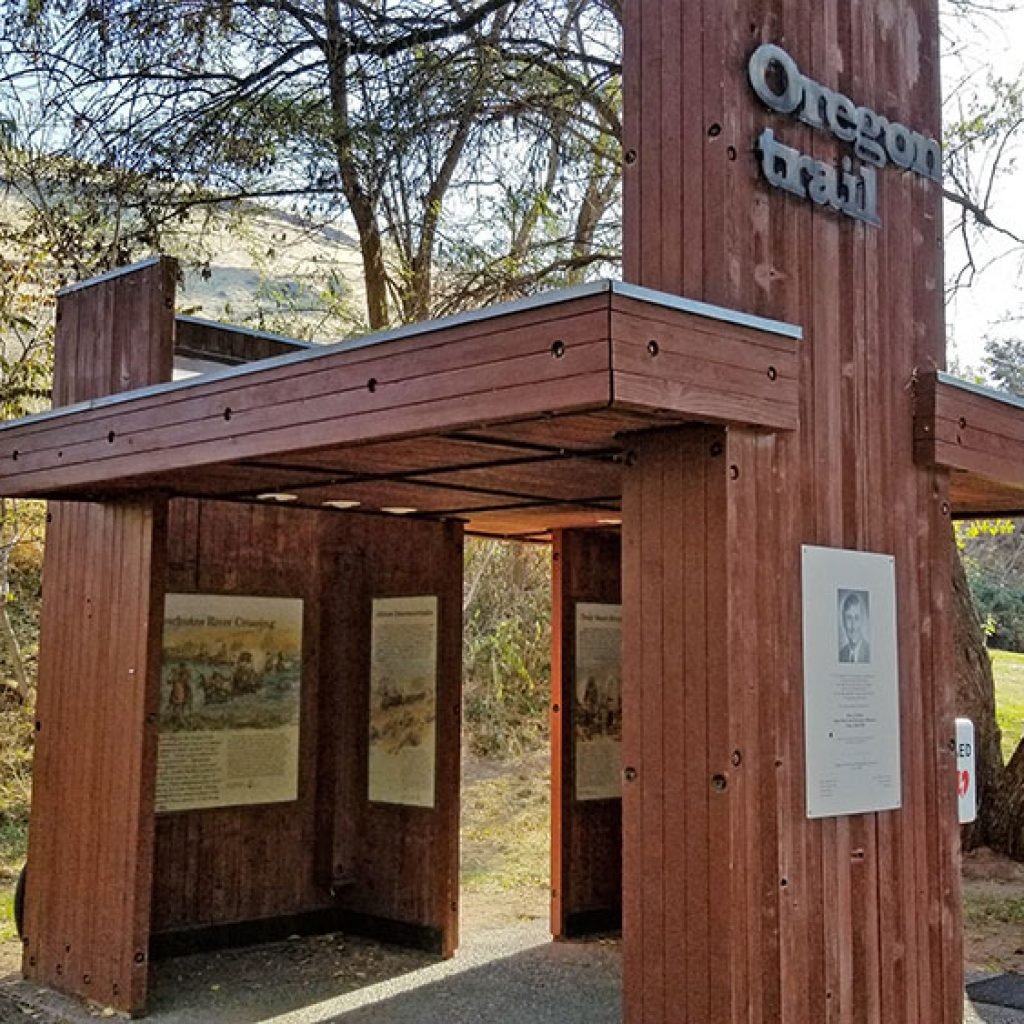
The Oregon Trail crossing of the Deschutes River, near the Deschutes River State Recreation Area, was difficult for emigrants. They often camped at the mouth of the Deschutes where it entered the Columbia River before crossing. In order to cross, some emigrant parties used the rocky islands near the river’s mouth as stepping stones, while wagons were floated across and stock animals swam. Some crossed the river assisted by local Native Americans and ferry operators.
The original river crossing now lies beneath Lake Celilo, but wagon ruts are still visible on the hill across rver. Exhibits at the Oregon Trail interpretive kiosk tell the emigrant story. Photos courtesy of Benjamin Asmus
Deschutes River Recreation Lands

These U.S. Department of The Interior signs welcome visitors to the Deschutes River public recreation area. The Lower Deschutes River is managed cooperatively by three agencies: Prineville District, Bureau of Land Management; the Confederated Tribes of Warm Springs; and Oregon Parks and Recreation Department.
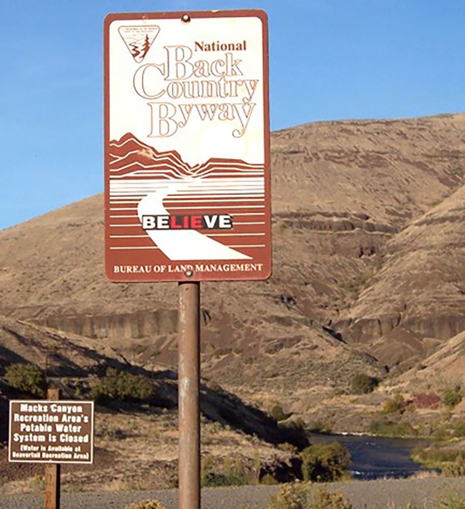
National Back Country Byway
National Back Country Byway, U.S. Department of the Interior, Bureau of Land Management.
Spanning 32 miles along the east bank of the Lower Deschutes Wild and Scenic River, this back country byway offers close-up views of rapids and steep canyon country. Twelve paved miles originate in Maupin and connect to state highway 216 near Sherar’s Falls. The remainder of the byway is surfaced with high-standard gravel, suitable for passenger vehicles.
John Day River
Cottonwood Canyon State Park
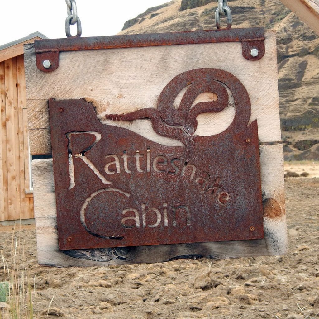

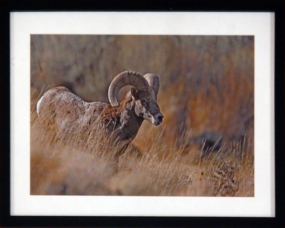
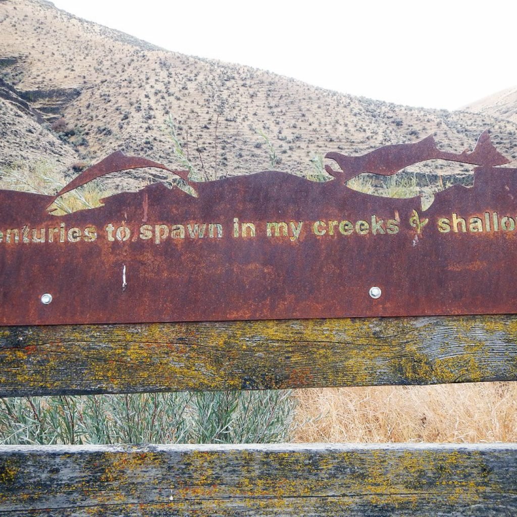
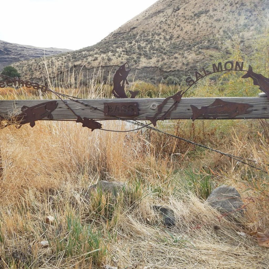
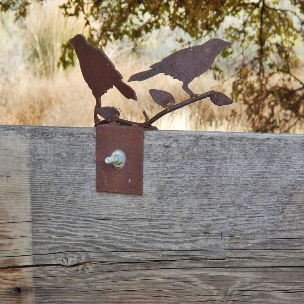
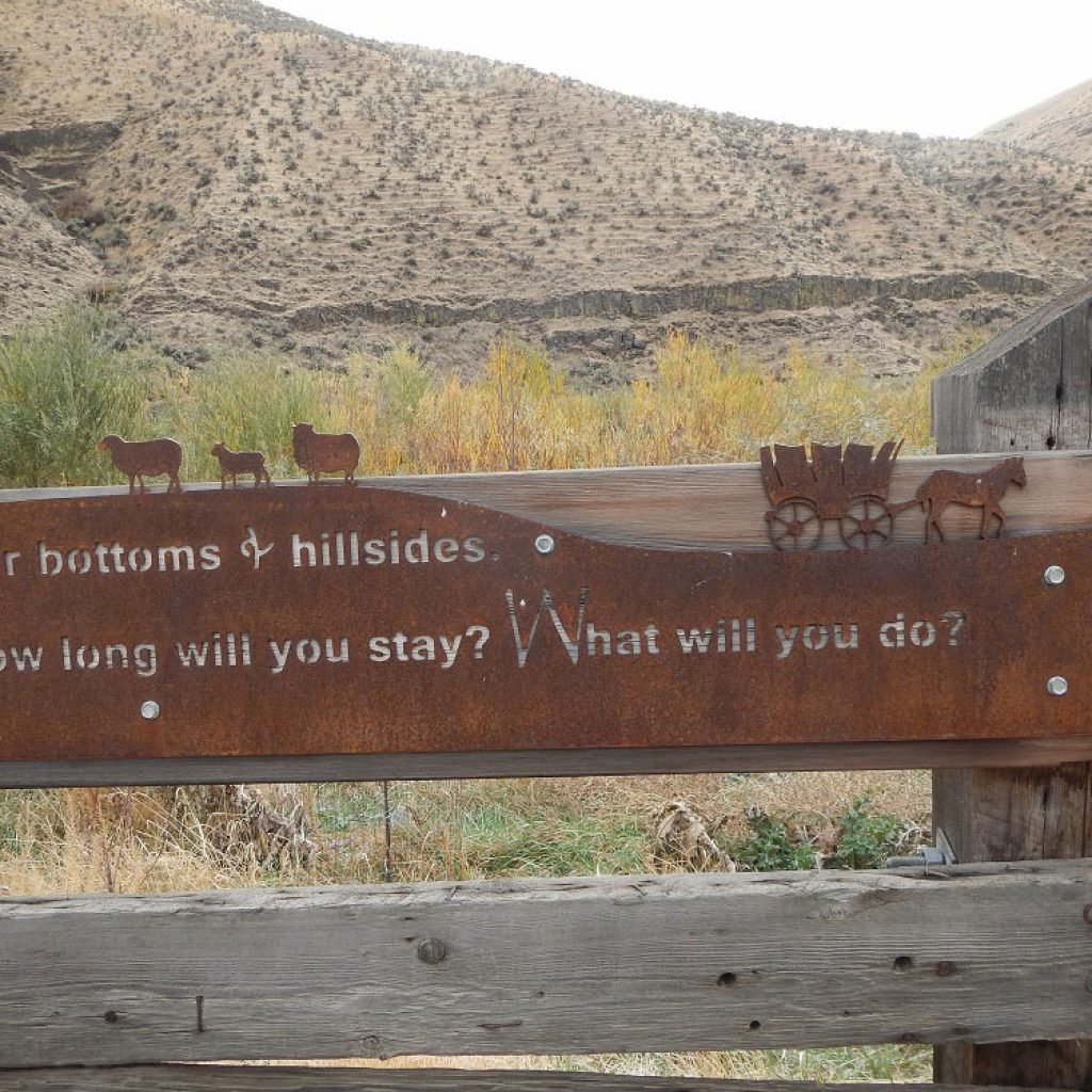

Art is in the air, the land, everywhere… in the cabins and on signs, wire sculpture and fences at Cottonwood Canyon State Park. Photos by Asa Miller, Park Ranger.
Grass Valley, Oregon

Metal artist Chris Huffman, who grew up in Sherman County and attended Sherman High School, created this sign for the city of Grass Valley to greet visitors to the community. Photo courtesy of Jean Luxford Hulbert
Moro, Oregon
Sherman County Courthouse

The Sherman County Courthouse is one of only three county courthouses in Oregon to be used continuously since its construction in 1899. The Courthouse is located at 500 Court Street in Moro, Oregon. It was designed by prolific architect Charles H. Burggraf and built by A.F. Peterson in 1899 using brick sourced and manufactured locally in Moro. A Queen Anne-style building, it was listed on the National Register of Historic Places (NRHP) in 1998.
Sherman County Courthouse with a new cupola. Photo courtesy of James Burgett
Will Raymond Photograph Collection

Will Raymond is remembered for his skill as a photographer. Hanging in the Sherman County Courthouse is this collection of photographs displayed at the Lewis and Clark Centennial and American Pacific Exposition and Oriental Fair in Portland in 1905. Photos courtesy of Joe Dabulskis, Sherman County Judge.
Sherman County Time Capsule

On February 25, 1989, Sherman County celebrated our county’s founding. At Sherman High School that morning historians, farm awards, a centennial logo, old-time films and the historical society’s slide show, The Land Between The Rivers, were on the program. At the courthouse in the afternoon, we celebrated with cake and song, a postal cancellation, cake contest and souvenirs. Sen. Wayne Fawbush dedicated the time capsule and Rep. Greg Walden assisted in a tree planting.
Sherman County students and their teachers from all four districts visited the Courthouse and Museum in February, receiving informational handouts, tours, commemorative buttons and, at the museum, birthday cake. ~The Plow, Sherman County Historical Society
Interment September 8, 1989
Disinterment September 8, 2039.
Sherman County Elected Officials
- Gordon Hilderbrand – County Judge
- John Schadewitz – County Commissioner
- Robert Boynton – County Commissioner
- Linda Cornie – County Clerk
- Gerald Lohrey – County Sheriff
- Richard Stradley – County Assessor
- Nancy McCoy – County Treasurer
- Ray English – District Attorney
- Cathie Martin – Justice of the Peace.
Sherman County Time Capsule Committee
- Frank David Reid, D.M.D.
- “It is indeed a desirable thing to be
- well descended but the glory belongs
- to our ancestors. -Plutarch.”
Photo courtesy of Kristi Weis
Moro City Park
This contemporary take on Sherman County history stretches along the Moro City Park wall between 2nd and 3rd Streets and below Main St. (Hwy 97).
The Oregon Department of Transportation and the City of Moro collaborated with the Sherman County Historical Society on the concrete relief mural designed by Pat Jacobsen. Dale Coles and Larry Triebelhorn, Moro City councilors, fabricated the concrete forms. Photos courtesy of the Sherman County HIstorical Society and Sherry Kaseberg.
Rufus, Oregon
Giles French Park
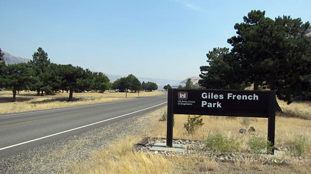
Giles French Park, downstream from the John Day Dam, is named for Giles L. French, Sherman County journalist, publisher, editor, author and legislator.
Giles French (1894-1976) was a farmer, stockman, U.S. Army veteran and a founder of the Sherman County Club that served to educate, develop and promote Sherman County. He served as mayor of Moro for 20 years and in the Oregon legislature 17 years. He edited and published the Sherman County Journal 1931-1963. He was the author of four books, and briefly taught a history class at Sherman High School. In 1994 he was named to the Oregon Newspaper Publishers Hall of Fame.
His gifts to the people of Sherman County are the vast amounts of local history preserved in the weekly Sherman County Journal, the books he wrote, especially The Golden Land, A History of Sherman County, Oregon, and the influence he had on others. His autobiography was published in Sherman County: For The Record.
Photos courtesy of Army Corps of Engineers
Rufus Industrial Park
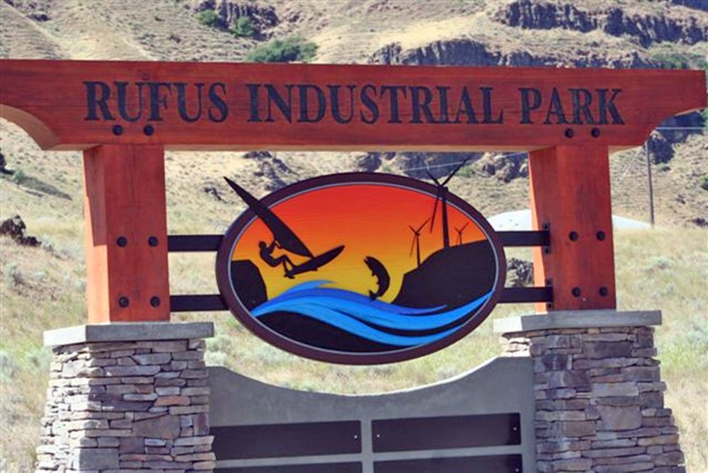
The sign for the Rufus Industrial Park, installed in 2011, welcomed commercial development between Highway 30 and the basalt bluffs at the west side of Rufus.
Wasco, Oregon
City of Wasco
“Welcome to Wasco! Home of the Historic Columbia Southern R.R. Depot, Memorial Day Celebration and gateway to the Oregon Trail.” ~Carol MacKenzie
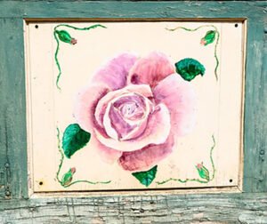
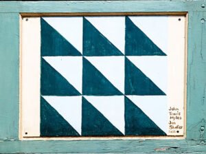
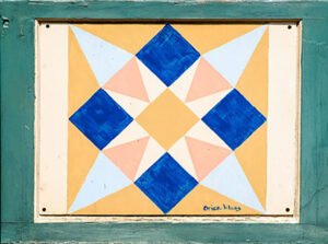
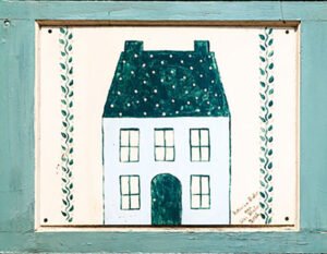
City of Wasco Quilt Block Trail
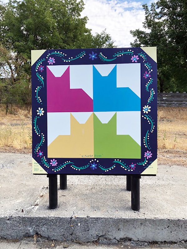
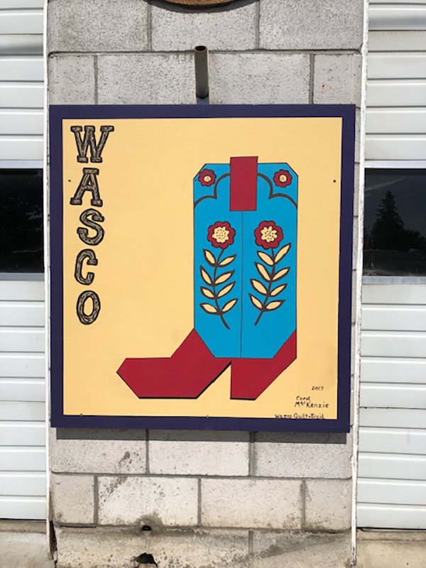

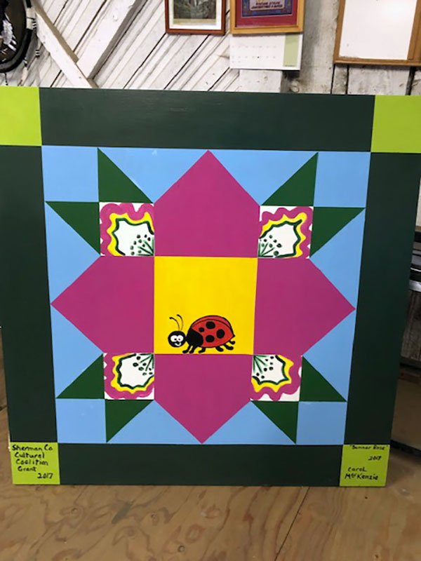
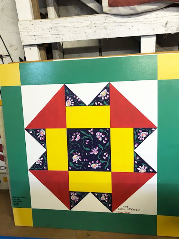
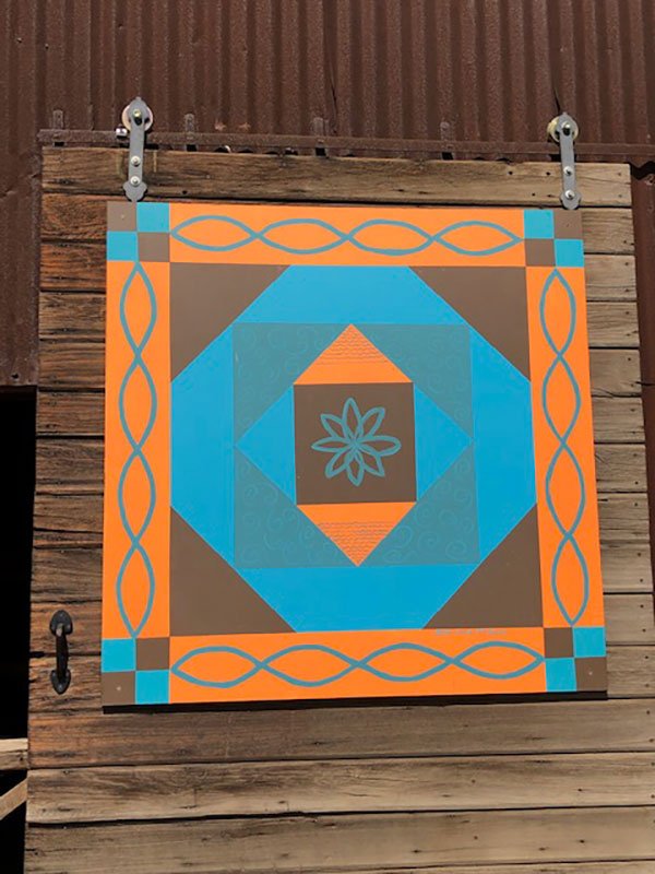


The City of Wasco and the Sherman County Cultural Coalition funded the supplies for the Wasco Quilt Trail in 2016. To encourage tourism, the 24 blocks were painted by Carol MacKenzie and installed in the downtown Wasco area by Tom Lepinski. Travelers stop to take photos. Can you find them?
Twenty-five volunteers contributed images of Sherman County public art for everyone to enjoy:
- Benjamin Asmus, Deschutes State Recreation Area
- Jessica K. Ball
- Dave Bergmann
- Susan Brown
- James Burgett, Sherman County
- Aaron Cook, City of Rufus
- Joe Dabulskis, Sherman County Judge
- Patti Fields, Sherman County Historical Society
- Jean Luxford Hulbert
- Erling Jacobsen
- Fred Justesen
- Linda Krafsic
- Cameron Kaseberg
- Jeremy Lanthorn
- Sue Mabe, Oregon State University Extension Service
- Carol MacKenzie
- Marylou Martin, Sherman County Public/School Library
- Verna McClennan, Mid Columbia Producers
- Asa Miller, Cottonwood Canyon State Park
- Oregon Department of Transportation
- Michael Peroni
- Lowell Smith, Sherman County Historical Society
- U.S. Army Corps of Engineers
- Sister Krista von Borstel
- Kristi Weis, Sherman County Clerk.
Thank you for your contributions to this endeavor.